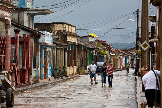
Laid out in a near-perfect grid, mostly residential Centro Habana (Central Havana, pop. 175,000) lies west of the Paseo de Martí and south of the Malecón. The 19th-century region evolved following demolition of the city walls in 1863. Prior, it had served as a glacis. The buildings are deep and tall, of four or five stories, built mostly as apartment units. Hence, the population and street life are dense. Many houses are in a tumbledown state, and barely a month goes by without at least one building collapse.
The famous department stores of prerevolutionary days have reopened; many still bear neon signs promoting U.S. brand names from yesteryear.The major west-east thoroughfares are the Malecón to the north and Zanja and Avenida Salvador Allende through the center, plus Calles Neptuno and San Rafael between the Malecón and Zanja. Three major thoroughfares run perpendicular, north-south: Calzada de Infanta, forming the western boundary; Padre Varela, down the center; and Avenida de Italia (Galiano), farther east.In prerevolutionary days, Centro Habana hosted Havana’s red-light district, and prostitutes roamed such streets as the ill-named Calle Virtudes (Virtues). Neptuno and San Rafael formed the retail heart of the city. In recent years, they have regained some of their life and the famous department stores of prerevolutionary days have reopened; many still bear neon signs promoting U.S. brand names from yesteryear. Caution is required, as snatch-and-grabs and muggings are common.
Officially known as Avenida Antonio Maceo, and more properly the Muro de Malecón (literally “embankment,” or “seawall”), Havana’s seafront boulevard winds dramatically along the Atlantic shoreline between the Castillo de San Salvador de la Punta and the Río Almendares. The six-lane seafront boulevard was designed as a jetty wall in 1857 by Cuban engineer Francisco de Albear but not laid out until 1902, by U.S. governor General Woods. It took 50 years to reach the Río Almendares, almost five miles to the west.
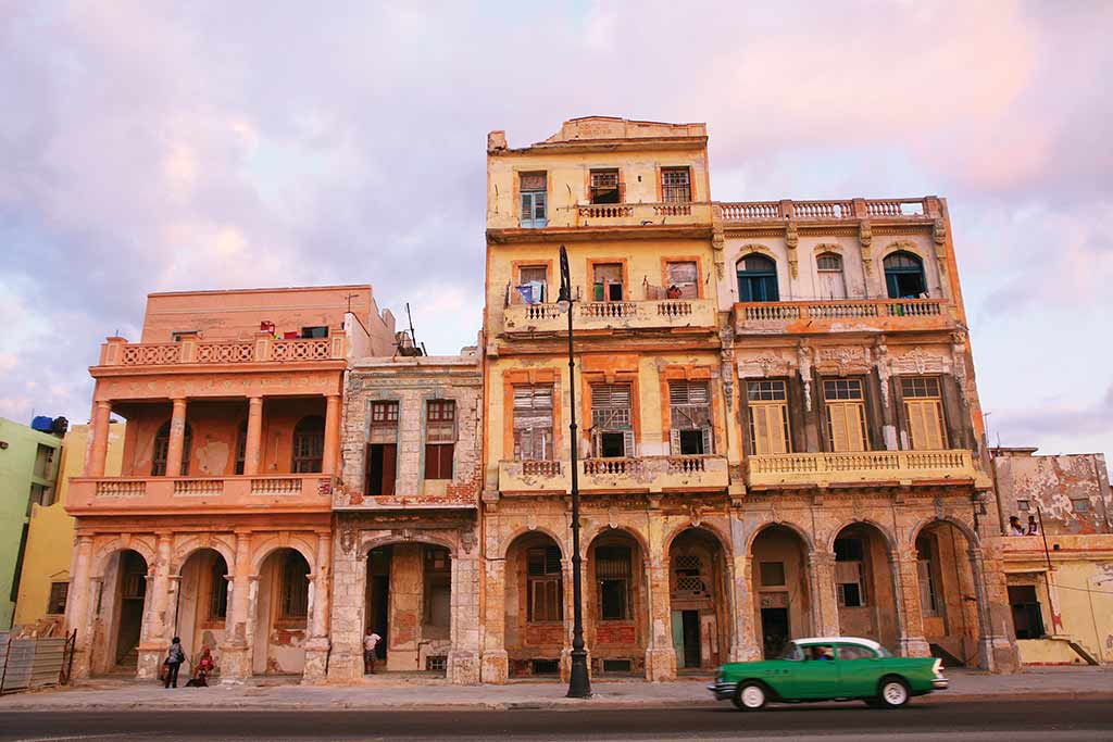
The Malecón is lined with once-glorious high-rise houses, each exuberantly distinct from the next. Unprotected by seaworthy paint since the Revolution, they have proven incapable of withstanding the salt spray that crashes over the seawall. Many buildings have already collapsed, and an ongoing restoration seems to make little headway against the elements.
Derelict building on the Malecon. Photo © Christopher P. Baker.
All along the shore are the worn remains of square baths—known as the “Elysian Fields”—hewn from the rocks below the seawall, originally with separate areas for men, women, and blacks. These Baños del Mar preceded construction of the Malecón. Each is about four meters square and two meters deep, with rock steps for access and a couple of portholes through which the waves wash in and out.
The Malecón offers a microcosm of Havana life: the elderly walking their dogs; the shiftless selling cigars and cheap sex to tourists; the young passing rum among friends; fishers tending their lines and casting off on giant inner tubes (neumáticos); and always, scores of couples courting and necking. The Malecón is known as “Havana’s sofa” and acts, wrote Claudia Lightfoot, as “the city’s drawing room, office, study, and often bedroom.”
The Malecón—the setting for spontaneous riots in the early 1990s—is also a barometer of the political state of Havana. During times of tension, the police presence is abnormally strong and the Malecón becomes eerily empty.
Every October 26, schoolchildren throw flowers over the seawall in memory of revolutionary leader Camilo Cienfuegos, killed in an air crash on that day in 1959.
Excerpted from the First Edition of Moon Havana.