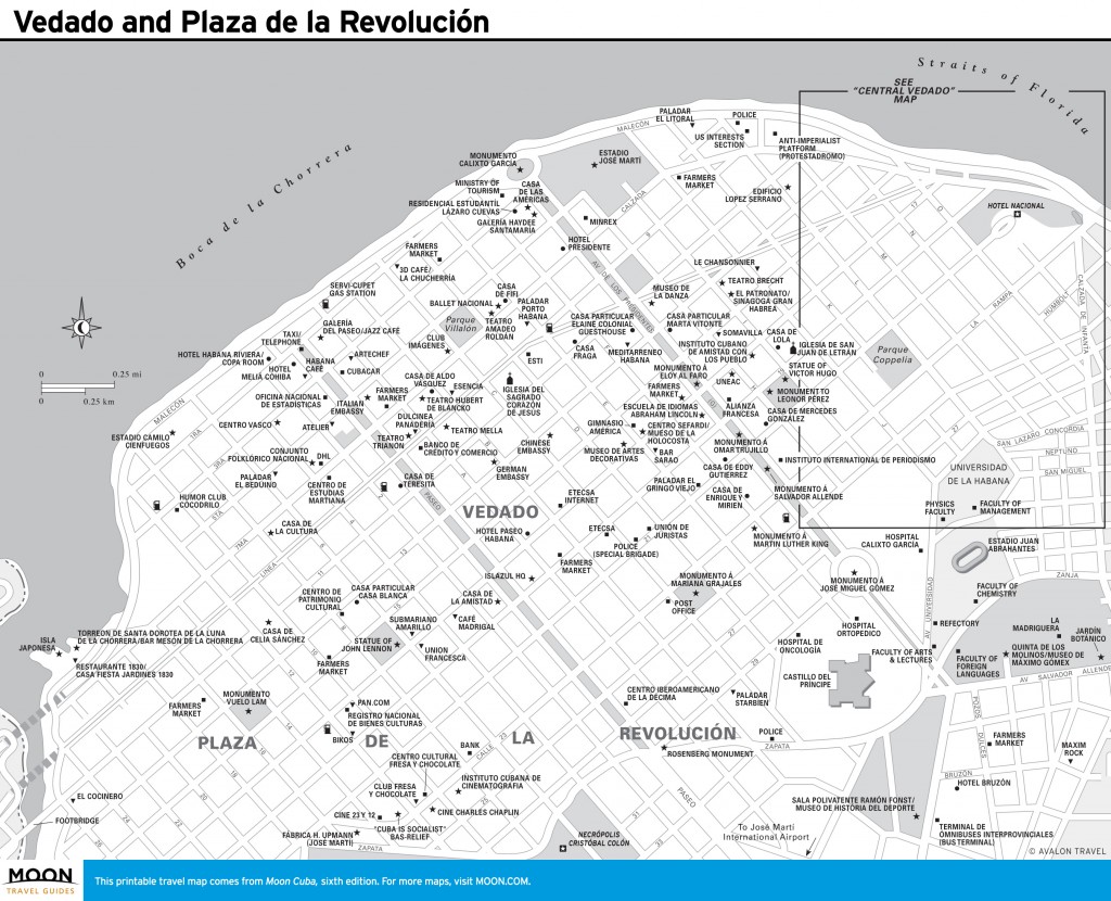
The municipio of Plaza de la Revolución (pop. 165,000), west of Centro Habana, comprises the leafy residential streets of Vedado and, to the southwest, the modern enclave of Nuevo Vedado and Plaza de la Revolución.
Vedado and Plaza de la Revolución.
Formerly a vast open space between Centro Habana and the Río Almendares, Vedado (which means “forest reserve” or “forbidden”) served as a buffer zone in case of attack from the west.Vedado—the commercial heart of “modern” Havana—has been described as “Havana at its middle-class best.” The University of Havana is here. So are many of the city’s prime hotels and restaurants, virtually all its main commercial buildings, and block after block of handsome mansions and apartment houses in art deco, eclectic, beaux-arts, and neoclassical styles—luxurious and humble alike lining streets shaded by stately jagüeys dropping their aerial roots to the ground.Formerly a vast open space between Centro Habana and the Río Almendares, Vedado (which means “forest reserve” or “forbidden”) served as a buffer zone in case of attack from the west; construction was prohibited. In 1859, however, plans were drawn up for urban expansion. Strict building regulations defined that there should be 15 feet of gardens between building and street, and more in wider avenidas. Regularly spaced parks were mandated. The conclusion of the Spanish-Cuban-American War in 1898 brought U.S. money rushing in. Civic structures, hotels, casinos, department stores, and restaurants sprouted alongside nightclubs.
The sprawling region is hemmed to the north by the Malecón, to the east by Calzada de Infanta, to the west by the Río Almendares, and to the southeast by the Calzada de Ayestaran and Avenida de la Independencia. Vedado follows a grid pattern laid out in quadrants. Odd-numbered streets (calles) run east-west, parallel to the shore. Even-numbered calles run perpendicular. (To confuse things, west of Paseo, calles are even-numbered; east of Paseo, calles run from A to P.) The basic grid is overlaid by a larger grid of broad boulevards (avenidas) an average of six blocks apart: Calle L to the east, and Avenida de los Presidentes, Paseo, and Avenida 12 farther west.
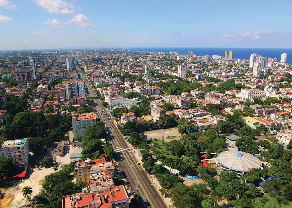
Aerial view of calle 23 in Havana. Photo © Christopher P. Baker.
Dividing the quadrants east-west is Calle 23, which rises (colloquially) as La Rampa from the Malecón at its junction with Calzada de Infanta. La Rampa runs uphill to Calle L and continues on the flat as Calle 23. Paralleling it to the north is a second major east-west thoroughfare, Línea (Calle 9), five blocks inland of the Malecón, which it meets to the northeast.
Vedado slopes gently upward from the shore to Calle 23 and then gently downward toward Nuevo Vedado and Plaza de la Revolución.
Excerpted from the First Edition of Moon Havana.