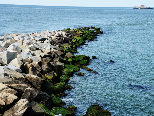
The Seward Highway curves around Turnagain Arm and can make for an exceptionally scenic drive. Photo © Frank Kovalchek, licensed Creative Commons Attribution.
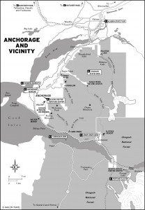
Anchorage and Vicinity
Cook Inlet bends east from Anchorage, becoming Turnagain Arm. The inlet was named by Captain James Cook’s master, William Bligh, who later captained the ill-fated HMS Bounty. The Seward Highway curves around Turnagain Arm, past the town of Girdwood and the turnoff to Portage Glacier and Whittier, and finally south over the Kenai Mountains to Seward, 127 miles away. The Turnagain Arm stretch is exceptionally scenic, but traffic is often heavy, so drive carefully and keep your headlights on at all times. Many people have lost their lives in traffic accidents on this narrow highway jammed against the cliffs, so always use extreme caution. Travelers will find places to watch birds, beluga whales, Dall sheep, and rock climbers along the way, and you can stop for hikes or to fish along the way.Potter Marsh is on the south edge of Anchorage, with a boardwalk extending into the marsh. This is a good spot to look for waterfowl, including Canada geese, trumpeter swans, and even the flyin’-fool Arctic terns. Bring binoculars and a light jacket for the often-breezy conditions. This marsh was created when the railroad builders installed an embankment to protect the track from Turnagain Arm’s giant tides, which dammed the freshwater drainage from the mountains.
A mile south on the other side of the highway is the Potter Section House (907/345-5014, Mon.–Fri. 8 a.m.–4:30 p.m. year-round), a small railroad museum of interpretive displays and signs outside and inside the restored original “section” house. This is also headquarters for Chugach State Park; get brochures on local trails here. Check out the nine-foot rotary snowplow once used to clear avalanches. A small gift shop sells railroad memorabilia and books.
Across the highway from Potter Section House is the parking lot for Potter Creek Trailhead, the first access to the Turnagain Arm Trail, which parallels the highway for over nine miles, with good opportunities to see Dall sheep, moose, and spruce grouse. The trail began as a turn-of-the-20th-century wagon road built to transport railroad workers and supplies. This is a very popular early summer path since its south-facing slopes lose the snow early. In three miles is McHugh Creek, an always- crowded day-use area and trailhead for the seven-mile hike up to Rabbit Lake. You can continue south along the Turnagain Arm Trail past three more trailheads all the way to Windy Corner Trailhead nine miles from your starting point, and not far from Beluga Point.
Twenty miles south of Anchorage is Beluga Point, a good place to see the small white beluga whales cavorting in Turnagain Arm in late May and late August; they follow salmon into these shallow waters. Unfortunately, overhunting by Native Alaskans caused the population of belugas to plummet in the 1990s, and they still have not recovered.
Look behind you for the Dall sheep that often wander close to the highway in this area. Or just have a picnic and wait for the Cook Inlet’s famous bore tides. The tides here, at 30 feet, are among the world’s highest, and the lead breaker can be up to eight feet high, a half-mile across, and can move at over 10 miles per hour. This is the only bore tide in the United States, created when a large body of water (Cook Inlet) is forced by strong tidal action into a narrow shallow one (Turnagain Arm). Look for a series of small swells (2–3 feet high, larger depending on the wind) that crash against the rocks and send up a mighty spray. You won’t soon forget the roar of the bore, which goes by Beluga Point roughly two hours after low tide in Anchorage—check the tide tables in the daily newspapers. One warning: Never go out on the Turnagain Arm mudflats at any time. The mixture of glacial silt and mud creates quicksand; people have drowned after getting their feet stuck in the mud and being inundated by the incoming tide. Don’t take a chance!
Twenty-five miles south of Anchorage, and right before Turnagain House Restaurant in Indian, take a left on the gravel road and head 1.5 miles to the Indian Valley Trailhead. This trail, which follows Indian Creek over Indian Pass (especially rewarding during Indian summer), is five miles of easy walking on a wellmaintained path. You can then continue for several miles of undeveloped hiking until you hook up with the Ship Creek Trail, which runs 22 miles to Arctic Valley north of Anchorage. The Powerline Pass Trail goes 11 miles from the Glenn Alps trailhead to Indian Creek Trail; look for the signed turnoff 100 yards up the Indian Valley Trail. Historic Indian Valley Mine (907/653-1120, mid-May–mid-Sept.) has summertime gold panning, historic buildings, a little museum, and a gift shop.
Two miles down the highway from Indian is the Bird Creek area, where dozens of cars line the roadside on July–August afternoons. They’re all here trying to hook a silver salmon in this very productive creek. A half-mile north of the creek is a parking area for Bird Ridge Trail, which climbs straight up this 3,500-foot promontory in less than two miles.
Also nearby is the Bird Creek Campground ($15), a surprisingly pretty place just off the busy Seward Highway. Campsites are just a few feet from Cook Inlet. This thickly forested campground is often full of anglers working Bird Creek. The Bird to Gird Bike Trail runs right through the middle of the campground, continuing north for three miles to Indian and south three miles to Girdwood along the old highway.
Excerpted from the Tenth Edition of Moon Alaska.