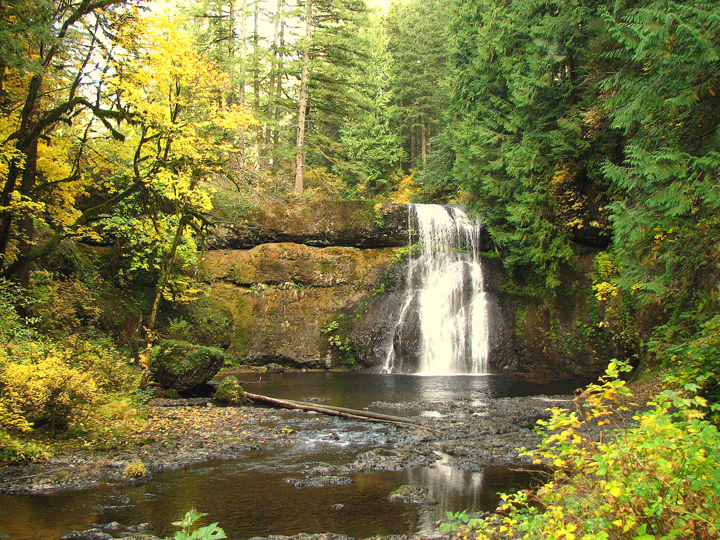
Upper North Falls in Silver Falls State Park. Photo © David Berry, licensed Creative Commons Attribution.
Who would imagine that one of the state’s top trails is only 10 minutes from downtown Portland? Thanks to 5,000-acre Forest Park, it’s true. One close-in access point onto the 30-plus-mile-long leafy haven of the Wildwood Trail is via the shorter but quite scenic Lower Macleay Trail. Reach it at the end of NW Upshur Street (the equivalent of NW 29th Ave. and Upshur St.).
This classic Columbia River Gorge trail starts near Bonneville Dam and follows Eagle Creek up past waterfalls and a profusion of springtime wildflowers. Your face will be misted with spray, and in places you’ll need to grab hold of cables bolted into the basalt cliffs as the trail narrows. The Eagle Creek Trail is 41 miles east of Portland on I-84. There are two common destinations: Punchbowl Falls is two miles in; Tunnel Falls is six miles from the trailhead. Hike back the way you came.
Most of Neahkanie Mountain, and the prominent headlands of Cape Falcon, are encompassed within the 2,500-acre gem of Oswald West State Park. Several hiking trails weave through the park, including the 13 miles of the Oregon Coast Trail linking Arch Cape to the north with Manzanita. To get there, head 10 miles south on U.S. 101 from Cannon Beach to the Cape Falcon Trail parking lot. Start there and head south on Cape Falcon Trail, where you can continue south to Neahkanie Mountain or north to Cape Falcon. There are excellent coastal views the entire way.
Ten waterfalls cascade off canyon walls in a forest filled with gargantuan Douglas firs, ferns, and bigleaf and vine maple at Silver Falls State Park.The best time to come is during fall foliage season when there are few visitors, just before icy roads and trail closures inhibit travel. To get there, drive 15 miles southeast of Silverton on Route 214 to get to the park. At the parking area near the South Fork of Silver Creek, start the 7.5-mile Trail of Ten Falls loop through Silver Canyon.
Majestic spires tower above the Crooked River at 623-acre Smith Rock State Park. Seven miles of well-marked trails follow the Crooked River and wend up the canyon walls to emerge on the ridgetops. Stay on well-worn paths. To get there, drive nine miles north from Redmond to NW Crooked River Drive and head north to the park entrance about 100 yards from the Rockhard Store. Begin your hike here, starting a five-mile loop over Misery Ridge.