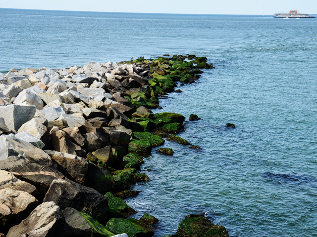
Chesapeake Bay in Virginia. Photo © m01229, licensed Creative Commons Attribution.
Coastal Virginia
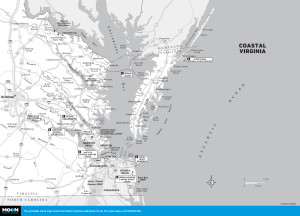
Coastal Virginia sounds like a simple concept: where the Atlantic Ocean meets the land. However, it’s much more complicated than that. The Chesapeake Bay is a defining feature along the coast, and the area where it opens into the Atlantic Ocean has developed into one of the largest and busiest natural ports on the globe. Several large rivers empty into the Chesapeake Bay as well, including the Potomac, Rappahannock, James, and York Rivers.The coastal region can be divided into five main areas. The first is the Northern Neck, which sits between the Potomac and Rappahannock Rivers, both of which flow into the bay. The Northern Neck is quiet and flat with many farms along the riverbanks. The area is quite historical and home to several noted sites including George Washington’s birthplace. The second area is known as the Historic Triangle, which includes the colonial cities of Williamsburg, Jamestown, and Yorktown. These cities sit along the James and York Rivers, which also flow into the Chesapeake Bay. Next is the huge area of Hampton Roads. This is where everything converges. The rivers flow into the bay just to the north, and the Chesapeake Bay flows into the Atlantic Ocean just to the east. The main cities in this area are Newport News, Hampton, and Norfolk. Then we have Virginia Beach. The Virginia Beach resort area is truly on the Atlantic Coast. Our final region, Virginia’s Eastern Shore, is sandwiched between the Chesapeake Bay on the west and the Atlantic Ocean on the east. It is sparsely populated compared to its mainland neighbors and offers charming historical towns and ample bird-watching and fishing.
Visiting Coastal Virginia requires some planning, a love of water, and no fear of bridges. Although there is some public transportation between specific cities, the easiest way to get around is by car. Highway 64 runs from Richmond down to the Historic Triangle and Hampton Roads areas, while Routes 17 and 3 traverse the Northern Neck. Route 13 runs the length of the Eastern Shore.
Coastal Virginia is a beautiful region but one that takes days, not hours to explore. If you are limited on time, select one or two key destinations such as Williamsburg and Virginia Beach, or maybe spend a day or two on the Eastern Shore. Wherever you decide to go, keep in mind that the area is heavily visited in the summer months, so you will likely have a few thousand close friends to share the experience with, especially in the historical towns and beachfront areas.
If you are looking for a one-of-a-kind experience, spend a day visiting Tangier Island. This isolated sandbar of a town is 12 miles out in the Chesapeake Bay and almost feels like a completely different country.
Excerpted from the First Edition of Moon Virginia & Maryland.