travel > Destinations > north america > United States of America > The Hiawatha Water Trail in Michigan

The Hiawatha Water Trail in Michigan

TIME : 2016/2/16 15:48:16
One of Lake Superior’s greatest kayaking destinations, the Hiawatha Water Trail passes along the shores of Marquette on the way from Big Bay to Grand Marais, a total of 120 miles.

The most beautiful portion of the trail lies to the east, along Pictured Rocks National Lakeshore between Munising and Grand Marais.The most beautiful portion of the trail lies to the east, along Pictured Rocks National Lakeshore between Munising and Grand Marais, but getting there will take some hard paddling. Access points and campgrounds are available along the way; get a copy of the official Hiawatha Water Trail Map at Down Wind Sports (514 N. 3rd St., Marquette, 906/226-7112).

Kayaking past Bridalveil Falls in Pictured Rocks National Lakeshore.

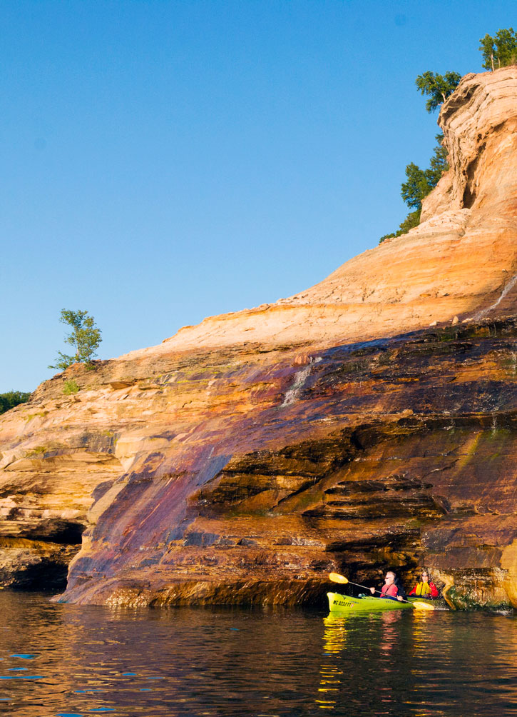
Bridalveil Falls in Pictured Rocks National Lakeshore. Photo © AllieKF, licensed Creative Commons Attribution Share-Alike.

Presque Isle is one of Marquette’s most beautiful destinations, and visitors who only see it from land are missing out: This is the ultimate kayak trip. More than two miles of jagged shoreline is dotted with rugged crags, towering sandstone cliffs, rocks, and an undeveloped shore. Put in and take out at the Presque Isle Marina.

For guided tours, contact Uncle Ducky Outfitters (434 E. Prospect St., 906/228-5447 or 877/228-5447). The six-hour “Paddlers Choice” tour runs $129 pp, while a half-day (4-hour) “Taste of the Rocks” tour is $99 pp. Uncle Ducky also offers guided tours of Marquette harbors, Presque Isle to Little Presque Isle, Huron Island, and Big Bay.

Travel map of Michigan's Upper Peninsula (East)

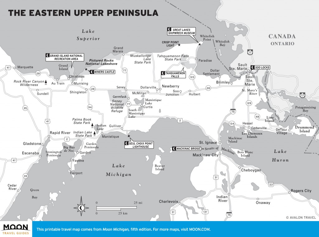
The Eastern Upper Peninsula


Excerpted from the Third Edition of Moon Michigan’s Upper Peninsula.