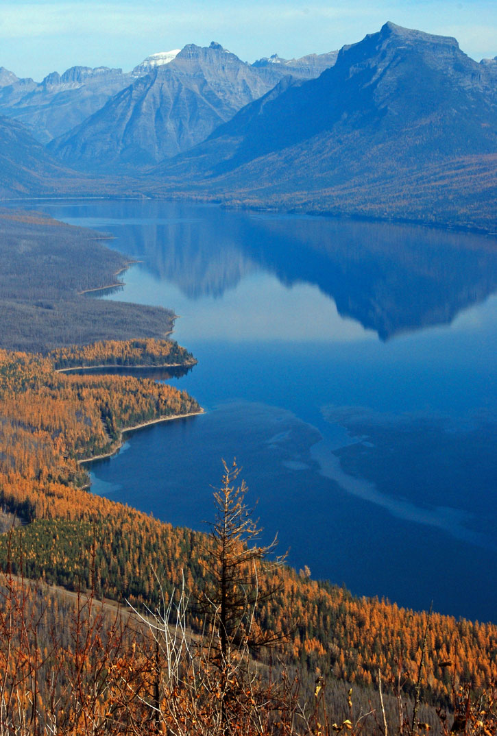
Apgar Lookout overlooks Lake McDonald and
Glacier’s peaks. Photo © Becky Lomax.
Today, many concessionaires are headquartered in West Glacier, just outside the national park boundaries. The small town has evolved into a seasonal mecca for rafting, guided hiking and backpacking, guided fishing trips, trail rides, and helicopter tours. Along with the train station, campgrounds, restaurants, motels, shops, and even an espresso stand, West Glacier is a place to gas up the car one last time before seeking the park’s interior. On Lake McDonald’s shores and inside the park, Apgar is calm in comparison. Although its restaurant, lodging, camping, shopping, boat ramp, and tiny west-side visitors center swarm in high season, miles of lake sprawl with blue waters and enough shoreline to find a niche for solitude.
For the Ksanka or Standing Arrow people, known today as the Salish and Kootenai, whose lands are at Flathead Lake’s south end, Glacier’s Lake McDonald area held special significance. Ten thousand generations ago, legend says, the Ksanka were first given a ceremonial dance by the spirits at their winter camp near Apgar. Originally called the Blacktail Deer Dance, the ceremony became an annual event for the Ksanka, and the area became known as “the place where people dance.” Today, the annual dance—now called the Jump Dance—takes place on the Flathead Reservation, but rapids on McDonald Creek still hold the original name, Sacred Dancing Cascade.
When the Great Northern Railway completed its westbound track in 1891, early visitors jumped off the train in Belton (now West Glacier) to see the area. With no bridge across the Middle Fork of the Flathead, visitors rowed across the river and then saddled up for a horseback ride to Apgar. Finally, in 1895 a rough dirt road eased the two-mile journey, followed two years later by a bridge across the river.
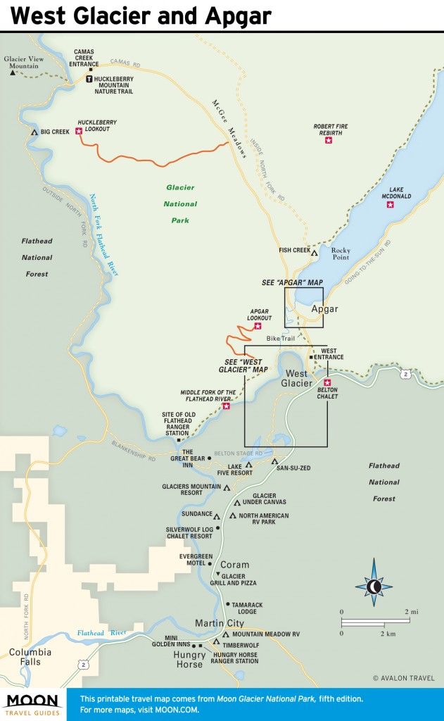
West Glacier and Apgar
As the railroad dropped visitors in Belton, Lake McDonald homesteaders leaped into the tourism business, offering cabins, meals, pack trips, boat rides, and guided tours. After Glacier became a national park in 1910, local landowners along the lake retained their property as inholdings. While private summer homes still exist within the park boundaries, to the envy of everyone, when sellers are ready, the National Park Service can purchase these properties at fair market value.
To coincide with Glacier’s first summer as a national park, the Great Northern Railway opened Belton Chalet in 1910 across from the depot.
Excerpted from the Fifth Edition of Moon Glacier National Park.