Along the Nez Perce National Historic Trail, Bitterroot Valley, near Victor, MT. Photo by Roger Peterson, courtesy of US Forest Service.
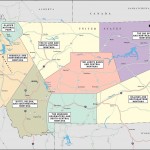
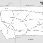
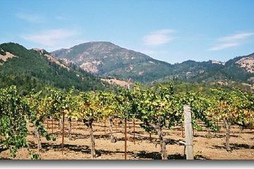
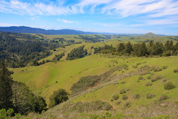
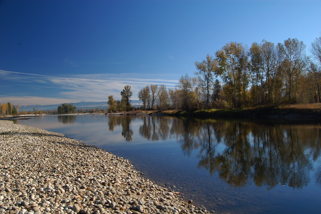
Probably nowhere else in Montana provides such a diverse and satisfying unity of attractions as the Bitterroot Valley. First of all, let’s make it clear that the Bitterroot is stunningly beautiful. The Bitterroot River, flanked by groves of cottonwood, winds through a wide fertile valley of farms and pastureland. The Bitterroot National Forest offers thousands of acres of wilderness, with more than 1,600 miles of maintained trails to dramatic peaks, pristine lakes, and wildlife viewing.The heavily wooded humped arch of the west-lying Bitterroot Mountains rears back to reveal precipitous canyons and jagged peaks. The Sapphire Range to the east is characterized by relatively low forested peaks. Historic, quiet old towns slumber in a purposeful way: There are comings and goings, but not much commotion.Opportunities for recreation are almost limitless. The Bitterroot River provides great fishing, and the streams flowing out of the Sapphire Mountains have better fishing than the Bitterroot drainages, which debouch from alpine lakes in rounded valleys scooped out by glaciers, then fall quickly through narrow canyons gashed through the resistant mylonite rock. The Bitterroot National Forest offers thousands of acres of wilderness, with more than 1,600 miles of maintained trails to dramatic peaks, pristine lakes, and wildlife viewing. Across the valley to the east the Sapphire Range offers gem hunting and more wildlife habitat. Proximity to Missoula lends sophistication to the services in the Bitterroot, but suburban sprawl also engulfs the lower valley with residential subdivisions.
The Flathead Indians came to the Bitterroot from the west, and although they made regular trips to the plains to hunt buffalo, they made ample use of the valley’s roots, huckleberries, and fish.
In 1805 Lewis and Clark passed down the Bitterroot Valley from the south, over Lost Trail Pass. The Corps of Discovery had already crossed the Continental Divide at Lemhi only to discover that although the Salmon River in Idaho flowed into the Columbia drainage, it did so as the aptly named “River of No Return.” The Salmon was hopelessly impassable. The corps climbed up into Montana again, this time to follow the Bitterroot down to the area near Lolo Creek, where they established a favorite camping spot called Travelers’ Rest. From here the corps followed Lolo Creek up and over Lolo Pass, and down more hospitable drainages to the Columbia. The following year they retraced their trail to Travelers’ Rest. Clark and half the corps returned up the Bitterroot to cross over Gibbon Pass into the Big Hole.
Lewis is responsible for the name of the plant that gives this valley its name. While local Indians found the roots of the bitterroot both tasty and fortifying, Lewis pronounced it bitter and nauseating. His name now identifies the plant in Latin: Lewisia rediviva.
The Bitterroot Valley, with its fertile bottomland and protected climate, attracted farmers from the beginning. The discovery of gold in nearby valleys and the establishment of mining boomtowns created a demand for foodstuffs. As farmers moved into the area, they began to pressure the government to remove the Flathead from the valley, and in 1872 James Garfield, who later became the 20th U.S. president, was sent to transfer the Indians north to the Mission Valley.
Five years later the Nez Perce passed through the Bitterroot on their tragic flight across the Northwest. Under the leadership of Chief Joseph, the band of about 700 Indians and nearly 2,000 horses traveled from Idaho down Lolo Creek and up the Bitterroot toward Crow country, fleeing the army infantry. Chief Joseph vowed to the army and the Bitterroot settlers to march peaceably through the settled areas of the Bitterroot in return for unmolested passage. The offer was not accepted officially, and the Nez Perce simply skirted a hastily constructed barricade at Fort Fizzle and proceeded up the Bitterroot. No shots were fired as they passed through the valley. Once over the Continental Divide in the Big Hole, however, Col. John Gibbon and 183 men ambushed the Nez Perce at the Battle of the Big Hole.
Farming really took hold in the Bitterroot after the Northern Pacific extended a spur line to Hamilton. One of the largest enterprises in the valley was Marcus Daly’s Bitterroot Stock Farm. The copper magnate from Butte preferred the Bitterroot as a summer home, and he built a magnificent mansion on his 26,000-acre holding. Considering the fact that Daly modeled his farm on an Irish manor, it’s no surprise that racehorses were the most noted of the farm’s products.
In the early years of the 20th century the Bitterroot was home to an elaborate irrigation scheme that turned the valley into a huge apple orchard. The Big Ditch, as it was functionally named, provided water to the eastside bench land, which was divided into subdivisions of 10 acres each. At the height of apple euphoria, 22,000 acres of the Bitterroot were in fruit production. The soil and climate didn’t quite live up to the exaggerated promises of the developers, and by the 1950s apple production ceased to be a significant element of the area’s economy.
While agriculture remains important in the Bitterroot, much of the farmland in the lower valley has now been subdivided into small “ranchettes.” This part of the valley has largely been converted into a bedroom community of Missoula.
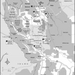
The Bitterroot National Forest contains 1.6 million acres, with nearly 750,000 of these protected as wilderness. Forest Service roads provide entrance for mountain bikers or off-road vehicle enthusiasts, while 950 miles of maintained trails give hikers access to some of the most tortured geology and pristine landscapes in the Rockies.
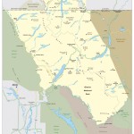
All the larger streams that feed into the Bitterroot River harbor rainbow, cutthroat, and brook trout, and some of the higher lakes in the Bitterroots, such as the Big Creek Lakes, are known for good fishing.
For the angler, though, the real news is the Bitterroot. The river seems largely untainted by the effects of a century’s worth of forestry, farming, suburban sprawl, and irrigation. In fact, even in the busy heart of the valley, the cottonwoods and willows that line the shore shield the angler from the realities of Bitterroot development. The trout here are both numerous and large. Rainbows and browns fill the majority of creeks, but cutthroat and the elusive bull are also apprehended. The lower part of the river near Missoula is where the lunkers are most likely lurking (and, rumor has it, largemouth bass), while farther south, up Connor way, is where the trout are thickest.
The state has established 10 fishing-access sites on the river, and there’s also easy access from bridges. At no place is the Bitterroot far from the road, although remember to ask for permission before crossing private land. Boat rentals are available in Hamilton, and organized float and fishing trips are offered by the region’s many outfitters.
Excerpted from the Eighth Edition of Moon Montana.