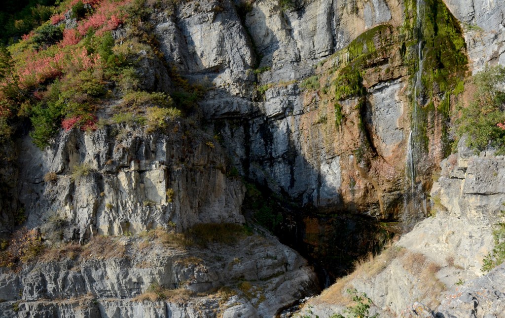
Stewart Falls on Mount Timpanogos. Photo © Mike Matson.
The Stewart Falls Trail starts on the far left side of the Aspen Grove Trail parking lot near the Theatre in the Pines. The trail starts off steeply, but quickly levels off to the nearly flat grade it maintains all the way to the falls. The path leads through a forest of evergreens and aspens, punctuated by Rocky Mountain maples.
At 0.3 mile a trail joins the Stewart Falls Trail from the left, leading up from the Aspen Grove Family Camp and Conference Center. At 0.6 mile the forest has become almost entirely aspen trees, with a blanket of bracken ferns cloaking the forest floor. The trees open up at 1.2 miles to reveal views down to Sundance Ski Resort to the left of the trail and the gray cliff bands of Mount Timpanogos to the right. You’ll starting getting glimpses of Stewart Falls at 1.6 miles as the trail drops gently into a large natural amphitheater. The trail reaches an overlook of the falls and a trail junction at 1.9 miles. Follow this trail down a short hill to get close to the base of the falls, or enjoy the view from the overlook before returning to the car.
Stewart Falls can be reached by hiking up from the Sundance Ski Resort. The trail from Sundance is 1.5 miles long for a 3.0-mile round-trip.
From Salt Lake City, drive south on I-15 for 33 miles and take Exit 272. Drive east along Highway 52 (800 North) in Orem for 3.7 miles to the junction with Highway 189/Provo Canyon Road. Drive east on 189 for 7 miles and turn left on Highway 92/Alpine Scenic Byway. Continue 4.8 miles and turn left into the Aspen Grove trailhead parking lot.
There is an American Fork Canyon fee of $6 for a three-day pass, $12 for a seven-day pass, or $45 for an annual pass. The America the Beautiful pass is accepted here. Dogs on leash are allowed. For more information, contact the Pleasant Grove Ranger District, Uinta-Wasatch-Cache National Forest, 390 North 100 East, Pleasant Grove, UT 84062, 801/785-3563.
Excerpted from the First Edition of Moon Take a Hike Salt Lake City.