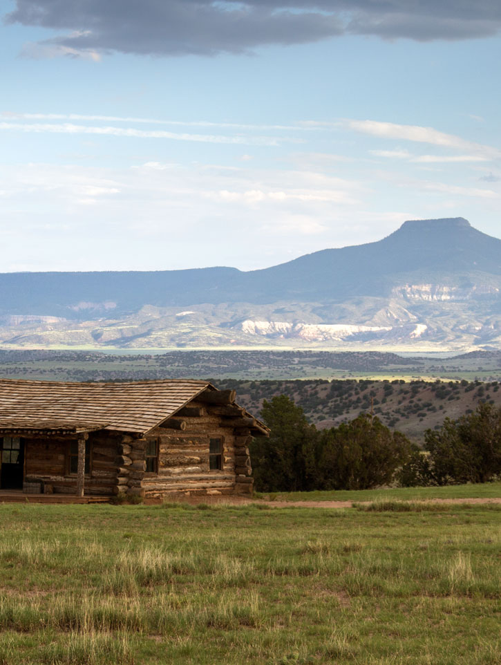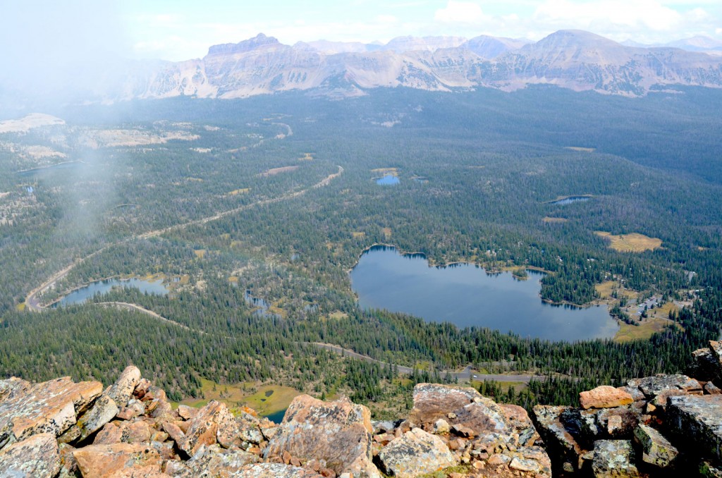
The view from Bald Mountain to Mirror Lake. Photo © Mike Matson.
During summer, the summit of Bald Mountain offers a pleasantly cool escape from the heat of Salt Lake City. There’s almost always a breeze on the upper ridge, and temperatures promise to be 30 degrees cooler at 12,000 feet. The weather always seems to be different in the Uintas than it is in Salt Lake City, so plan accordingly. Thunderstorms often build in the afternoon, making Bald Mountain a better morning destination. Also remember to throw in a rain jacket and some warm clothes, even if it feels crazy when you leave home.
The Bald Mountain Trail heads northwest from the gravel parking lot. The red dirt trail climbs gently for the first 0.5 mile, following a series of long mellow switchbacks through boulders and stands of subalpine fir trees. Right from the start of the trail, the views on Bald Mountain are sweeping, and they grow more spectacular with each passing switchback. The Mirror Lake Scenic Byway is visible below, looping up and over Bald Mountain Pass.
The wide, well-traveled trail is easy to follow as it climbs through a series of rock ledges on the mountain’s southwest ridge. By 1 mile, the patches of evergreen trees have completely disappeared and the landscape is dominated by expansive slopes of rock talus. Bald Mountain is one large exfoliating mound of rock. Frost wedging causes much erosion of the peak. Melted snow trickles down into the surface rocks and freezes, expanding and breaking the top layers of rock into smaller pieces. After millions of years of repetition, this process has turned this ridge into one giant talus field of small boulders. This trail sees enough traffic that many of the boulders have been tossed aside, leaving a smooth path to walk on.
At 1.2 miles the trail reaches the edge of the dramatic cliffs marking the top of the east wall of Bald Mountain. The view down to Mirror Lake, almost 2,000 feet below, is astounding. Beyond the lake, 12,479-foot Hayden Peak dominates the skyline.
The last 0.5-mile walk along the ridge is what spending time in the mountains is all about. Bounding across the lichen-blanketed rocks, it’s hard not to be struck by the sheer open expanse of space and beauty that stretches out around you in every direction. Lakes dot the wide, glacial-scoured valleys below, reflecting the light from the sky. Treeless ridges rise like backbones from the valley floor, which is covered by a carpet of green forest. By 1.4 miles you’ll have reached the summit. Soak up the beauty a little longer before heading back down the way you came.
If you’re looking for an extension to the Bald Mountain Trail, you can add as many miles as you’d like by continuing on down from the parking lot on the Notch Mountain Trail. The Notch Mountain Trail leads 10 miles to the Crystal Lake trailhead.
From Salt Lake City drive east on I-80 for 25 miles to Exit 146 for U.S. Highway 40 toward Heber. Merge onto U.S. Highway 40 and drive 3.8 miles to Exit 4 for Park City/Kamas. Take Exit 4 and turn left off the exit ramp to follow State Route 248 for 11.4 miles to Kamas. From the intersection of Main Street (Route 32) and 200 South (Route 248) in Kamas drive north on Route 32 and turn right (east) after one block on Mirror Lake Scenic Byway (Route 150). Continue east on Route 150 for 29.1 miles to the Bald Mountain trailhead on the left side of the road.
There is a fee of $6 for a three-day pass, $12 for a sevenday pass, or $45 for an annual pass. The America the Beautiful pass is accepted here. Dogs on leash are allowed. For more information, contact the Heber-Kamas Ranger District, Uinta-Wasatch-Cache National Forest, 50 East Center Street, Kamas, UT 84036, 435/783-4338.
Excerpted from the First Edition of Moon Take a Hike Salt Lake City.