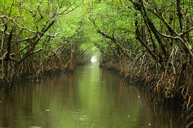
Everglades water way on a rainy afternoon. Photo © Chauncey Davis, licensed Creative Commons Attribution.
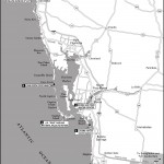
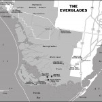
Everglades National Park is the third-largest park in the continental United States and has been designated a World Heritage Site, an International Biosphere Reserve, and a Wetland of International Importance. It’s the only subtropical preserve in North America, containing both temperate and tropical plant communities. Really, it’s the only everglade in the world.mailing address: 40001 Hwy. 9336, Homestead, FL 33034-6733, 305/242-7700; in Everglades City: Gulf Coast Visitor Center, 815 S. Copeland Dr., 239/695-3311, 8 a.m.–4:30 p.m. daily mid- Nov.–mid-April, 9 a.m.–4:30 p.m. mid-April– mid-Nov., no entrance fee on this side of the park
Still, I don’t think any of this conveys exactly what’s so cool. The Seminoles called the park “grassy water,” because it is essentially a wide, shallow river with no current, no falls or rapids, that flows very slowly southward along the subtle slope of the land, eventually meeting open water in Florida Bay 100 miles away. This river flows along sawgrass prairies, mangrove and cypress swamps, pinelands, and hardwood hammocks. Everywhere there are wading birds, alligators, dense and exotic tropical plantlife. But the U.S. government looked on all this as a dud, a big goose egg. In 1850, the federal government passed the Swamp and Overflowed Lands Act, which essentially gave people the latitude to manhandle this delicate ecosystem in any way they saw fit in an effort to make the land “useful.” By the 1880s developers started digging drainage canals that eventually caused major silting problems. And in the early 1900s the first of several South Florida land booms saw the transforming of huge swaths of wetland to agricultural land crisscrossed by canals and new roads. Unsightly mangroves (essential for the maintenance of shorelines in these areas) were removed in favor of more picturesque palms.
The park is still being rerouted, uprooted, and damaged in a variety of ways, but the wilderness is being increasingly protected and restored and is very much worth visiting. Everglades boosters Ernest F. Coe and Marjory Stoneman Douglas (author of The Everglades: River of Grass) eventually brought their case for conserving the area to President Harry S. Truman and convinced him to dedicate the vast swath as Everglades National Park in 1947. The park is still being rerouted, uprooted, and damaged in a variety of ways, but the wilderness is being increasingly protected and restored and is very much worth visiting.The Everglades region is mild and pleasant December–April, rarely reaching freezing temperatures, and mostly without a drop of rain. Summers are hot and humid, with temperatures hovering around 90°F and humidity at a fairly consistent, steamy 90 percent. And, as with most places along the Gulf Coast, there are tremendous afternoon thunderstorms in the summer.
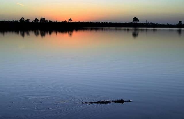
A visitor at the bank of Pine Glades Lake in Everglades National Park. Photo © W. Tipton, licensed Creative Commons Attribution.
The Everglades proper is the mainland, about 4,000 square miles of flat prairie grass that slopes southward at one-fifth of a foot per mile. The rainfall averages fifty-five inches, June through October. In rainy season, the most southwest part near the mangroves gets anywhere from a few inches up to two or three feet under water…. The strip of mangrove mainland has many little rivers not much wider in the narrows than a rowboat, running all the way to the grasslands of the Glades. In rainy season these rivers slowly drain the rainwater off the Glades into the Islands. As the rainwater from the Glades mixes with the saltwater coming in from the Gulf, it becomes brackish. Most all the fish and a big portion of the wildlife, especially the saltwater birds, do most of their breeding and feeding in the brackish water here.
The fish and the wildlife all follow the brackish water line. In the driest of the season, April and May, the brackish line is at the very head of the rivers near the Glades, and so are the fish and game. As the rains come on, the brackish line slowly drifts down the rivers into the Islands and eventually to the coast. —Loren G. “Totch” Brown, from Totch, A Life in the Everglades
He would know. He spent most of his life finding ways to eke out a life in this lush, junglelike wilderness at the bottom of the state of Florida.
The eastern diamondback rattlesnake, dusky pigmy rattlesnake, cottonmouth, and coral snake all fall under this category. Alligators very, very seldom attack adults, even if you’re thrashing about in the water. Dogs and small children are less safe from them. Keep both away from water’s edge unattended. Do not, under any circumstances, feed the alligators, even if it’s entertaining. It teaches them bad habits. You don’t want to see a gator sit up and beg. Crocodiles, on the other hand (there are fewer of these in the Everglades), are larger and more ferocious.
American Alligator lurking near the Anhinga Trail in Everglades National Park. Photo © Joe Parks, licensed Creative Commons Attribution.
Mosquitoes are pretty fierce in the summer (always bring bug spray and long sleeves to thwart them as best you can). Information on mosquito levels during the summer is available at 305/242-7700. Also, there are a few poisonous plants: poison ivy, poisonwood, and the manchineel tree. You might want to research these plants’ leaf shape so you can avoid brushing up against them.
The Anhinga Trail (at Royal Palm) and Eco Pond (a mile past the Flamingo Visitor Center) are good for birding. There’s also a train tour at Shark Valley that birders enjoy. Canoeists like paddling into Chokoloskee Bay (Gulf Coast) and Snake Bight (near Flamingo) to see the waterbirds feeding on mudflats. For freshwater canoeing, try Nine Mile Pond. Serious canoeists tackle the Wilderness Waterway, the backcountry route linking Everglades City to Flamingo. Check at the Gulf Coast Visitor Center for canoeing maps, directions, and rentals (there’s no launch fee at the Gulf Coast Visitor Center). A quick and easy way to get a sense of the immensity and majesty of the Everglades is to take one of the 90-minute boat tours (from the Gulf Coast Visitor Center, 239/695-3111, on the half hour 9am-4:30pm, no reservations necessary).
Even if you’re planning on doing primitive camping, backcountry permits are required (they’re free; they just help keep track of visitors). There’s established beach camping in the Everglades, chickee (little cabin structures) camping along the rivers and bays, New Turkey Key camping, Plate Creek camping, and camping at South Lostmans. Go to the visitors center to get a map and detailed description of all the established campsites and more primitive options. Camping at park campgrounds is $16 per night, and a backcountry camping permit costs $10 per night (plus $2/person/night, maximum 14 days).
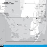
Lodging is available in communities that border the park, including Homestead, Florida City, Miami, Everglades City, and Chokoloskee.
Excerpted from the Fourth Edition of Moon Florida Gulf Coast.