Travelers moving south overland through Central America gradually have their choice of routes whittled away until they finally reach the end of the road in the swamps and forests of Darien, in Panamá, where the tenuous land bridge separating the two great American continents is nearly pinched out and the Pacific Ocean and the Caribbean Sea almost meet. Costa Rica lies at the northern point of this apex—a pivotal region separating two oceans and two continents vastly different in character.
Costa Rica sits astride a jagged series of volcanoes and mountains.The region is a crucible. There are few places in the world where the forces of nature so actively interplay. Distinct climatic patterns clash and merge; the great landmasses riding atop the Cocos and Caribbean Plates jostle and shove one another, triggering earthquakes and spawning volcanic eruptions; and the flora and fauna of the North and South American realms—as well as those of the Caribbean and the Pacific—come together and play Russian roulette with the forces of evolution. The result is an incredible diversity of terrain, biota, and weather concentrated in a country that, at 50,895 square kilometers (19,651 square miles), is barely bigger than the state of New Hampshire.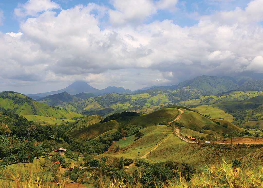
The highlands near Arenal Volcano in Costa Rica. Photo © Christopher P. Baker.
Lying between 8 and 11 degrees latitude north of the equator, Costa Rica sits wholly within the tropics, a fact quickly confirmed on a rainy afternoon in the middle of the rainy season on the Caribbean lowlands or the Nicoya or Osa Peninsulas. Elevation, however, tempers the stereotypical tropical climate. In fact, the nation boasts more than a dozen distinct climatic zones.
Costa Rica sits astride a jagged series of volcanoes and mountains, part of the great Andean-Sierra Madre chain that runs the length of the western littoral of the Americas. The mountains rise in the nation’s northwestern corner as a low, narrow band of hills. They grow steeper and broader and ever more rugged until they gird Costa Rica coast to coast at the Panamanian border, where they separate the Caribbean and Pacific from one another as surely as if these were the Himalayas.
Volcanic activity has fractured this mountainous backbone into distinct cordilleras. In the northwest, the Cordillera de Guanacaste rises in a leap-frogging series of volcanoes, including Rincón de la Vieja and Miravalles, whose steaming vents have been harnessed to provide geothermal energy. To the southeast is the Cordillera de Tilarán, dominated by Arenal, one of the world’s most active volcanoes. To the east is the Cordillera Central, with four great volcanoes—Poás, Barva, Irazú, and Turrialba—within whose cusp lies the Meseta Central, a high plateau ranging in elevation from 900 to 1,787 meters (2,950-5,863 feet). To the south of the valley rises the Cordillera Talamanca, an uplifted mountain region that tops out at the summit of Cerro Chirripó (3,819 meters/12,530 feet), Costa Rica’s highest peak.
Excerpted from the Tenth Edition of Moon Costa Rica.