With dramatic open rolling land and jagged rocks, El Cajas National Park feels almost like the Scottish Highlands. Photo © mike, licensed Creative Commons Attribution No-Derivatives.
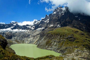
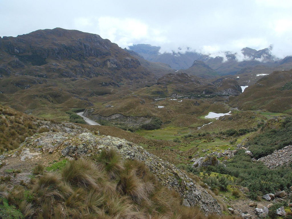
If you’re longing for fresh air and rugged landscapes after a few days’ sightseeing in the city, this huge national park on Cuenca’s doorstep is the best place to go. It’s only an hour from the city by bus, so it is easily visited on a day trip. With dramatic open rolling land and jagged rocks, Cajas feels almost like the Scottish Highlands. Among the park’s 28,000 hectares there are more than 200 lakes here and a variety of trails, ranging from a gentle hour-long stroll to two-day hikes. It’s also an excellent place for trout fishing, and even though it’s popular among locals, the park is big enough to find solitude.Most of El Cajas lies above 3,000 meters elevation, with páramo covering most of the rugged terrain. Frost and ice above 4,000 meters try their best to deter the thriving of hardy vegetation, such as the tiny quinoa tree, which clings to life higher than any other tree in the world. The park straddles the continental divide, so rivers rush both east to the Amazon and west to the Pacific Ocean. El Cajas is the continental divide’s most westerly point in South America.
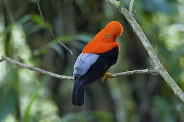
Visitors stand a good chance of seeing the wild llamas that were reintroduced to the park in the late 1990s. The park’s other animal inhabitants, such as spectacled bears, pumas, and oncillas, are more elusive. A long bird list includes hummingbirds, toucans, and Andean condors.
Fragments of Inca roads throughout the reserve link numerous tambos—ruins of way stations along the royal highway, which ran through here all the way to the coast. Traces of the roads connect Laguna Luspa to Laguna Mamamag, and Laguna Ingacocha to Laguna Ingacarretero. The area near Molleturo Hill has the highest concentration of ruins in El Cajas, where great views of Chimborazo and El Altar give evidence of the Inca skill at picking sites that were both scenic and easily defended. Other ruins can be found near Laguna Toreadora and Laguna Atugyacu.
The main route to El Cajas from Cuenca is along the main road down to Guayaquil, which climbs to 4,000 meters before dropping down dramatically to sea level in just 1.5 hours. Just 34 kilometers from Cuenca is the main entrance to the park at the Laguna Toreadora visitors center (6 a.m.–5 p.m. daily, park entry $2 pp).
Buses heading to Guayaquil every hour from Cuenca’s main terminal terrestre take about 45 minutes to reach Laguna Toreadora ($2). There are also buses run by Occidental leaving from their bus terminal (Mariscal Lamar and Miguel Heredia). To return, simply flag down a bus on the main road outside the entrance.
Ask to be dropped at the refugio (tel. 7/237- 0126), where you can pay the recently reduced entrance fee ($2 pp), which includes a free map and an information sheet. You can stay overnight here, but there is only capacity for six people, so advanced booking is advisable. There are kitchen facilities and electricity but no hot water.
You’ll certainly work up an appetite hiking here, and the restaurant just up the hill from the refuge serves great meals, including delicious locro de papas (potato soup, $2), trout ($4), and a three-course set lunch ($7.50).
El Cajas is full of hiking trails; eight are clearly marked, ranging from three hours to two full days. Note that groups numbering eight or more must be accompanied by a guide. Around Laguna Toreadora is the most popular short hike, the trail to Laguna Totoras and Laguna Patoquinuas takes about six hours, and climbing Cerro San Luis, the highest point in the park at 4,200 meters, takes about four hours. Another popular day hike is the trail from the Tres Cruces hill, four kilometers west of the information center, up over the continental divide (4,103 meters) and past Laguna Larga, Laguna Tagllacocha, and Laguna Luspa.
Overnight hikes include a trek to the Inca ruins by Lago Osohuayco and the hike from Miguir to the southern park guard post at Soldados. Be warned that trails have a tendency to peter out, and the weather can turn on you in a minute. Whatever time of year, the high elevation means it gets cold. Night temperatures can drop below freezing, and deaths from exposure have occurred here. Even during the day it’s cold, although it heats up considerably when the sun breaks through. The solution is to bring plenty of layers—ideally a thick sweater or jacket as well as waterproof clothing. Also bring maps, a compass, and waterproof boots. Consider fishing gear and a compass if you plan to wander far afield. Four IGM 1:50,000 maps cover the area: Cuenca, Chaucha, San Felipe de Molleturo, and Chiquintad, although the map included in the entrance fee is usually good enough.
The August–January dry season is the best time to visit, promising the most sun and regular but short rain showers. The rainy season, February–July, has the highest average temperature but more precipitation. The entire park is at 3,000–4,000 meters elevation, and high elevations make acclimation essential—hike high and sleep low. If you’re not adjusted to Cuenca’s elevation (2,500 meters), you’ll find hiking in Cajas very difficult. If traveling up from Guayaquil, you should ideally take a day or two to adjust before coming to El Cajas.
Tour companies in Cuenca organize excursions to El Cajas (from $40 pp). Try Expediciones Apullacta (Gran Colombia 11-02 at General Torres, Suite 111, tel. 7/283-7815). Overnight tours (from $150 pp) include a guide, food, transportation, and camping gear.
Excerpted from the Fifth Edition of Moon Ecuador & the Galápagos Islands.