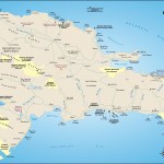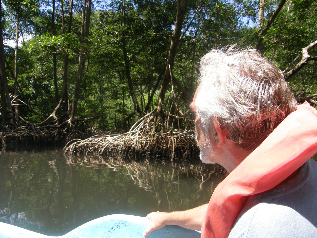
Boating in to a Dominican Republic National Park (Los Haitises pictured) past mangrove trees.
Photo by Bob licensed Creative Commons Attribution.
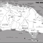
Topographically, the changing sea levels over the last million years created the peninsula out of limestone, resulting in a series of terraces and cliffs along the shoreline. Throughout the peninsula, traces of pre-Columbian Taíno life abound in subterranean tunnels and caves where many pictographs have been found. Although there are over 400 caves in the park, Cueva del Puenta is the easiest to visit by foot. It holds a small example of Taíno drawings depicting their culture, along with many stalactites and stalagmites.
To access this cave, you will need to find a guide at the ranger post located about five kilometers past Dominicus Americanus. You will pay a small entrance fee to the park of about US$3 and you will get a guide who will accompany you to the site and show you some of the drawings. Make sure to take a flashlight and wear good walking shoes. The tour takes about a half an hour.
The park’s coastline offers a variety of coral formations and is excellent for diving, especially along the western side. The eastern side of the peninsula has more limestone cliffs that drop off dramatically into the ocean. The southern tip has mangroves and saltwater lagoons and is a good spot to find birdlife. Many animals whose existence is threatened live in this protected area. Manatees (Trichechus manatus), the bottle-nosed dolphin (Turisops truncates), and various sea turtles swim the waters. The rat-like solenodon (Solenodon paradoxus), the hutia (Plagiodontia aedium), and the rhinoceros iguana (Cyclura cornuta) are found on land.
There is a Park Office (809/833-0022, 9 a.m.–1 p.m. daily) in the parking lot of Bayahibe where you can buy necessary permits (such as camping permits for Isla Catalinita), pay entrance into the park (RD$100), and ask questions about the park. If you have more in-depth questions regarding the Parque Nacional del Este contact The Ecotourism Department of the National Parks Office (809/472-3717), located next to Santo Domingo’s zoological gardens. Camping is not permitted for tourists in the Parque Nacional del Este.
One of the most popular ways to gain access to the park is to hire a boat (and guide) in the Bayahibe harbor. Your guide will take you along the shore, and from there you can hike into the parque. These prices are negotiable and vary quite a bit. Always agree on a price before setting out. If you’re coming via car, there are entrances at Bayahibe on the western edge and Boca de Yuma on the eastern side. Don’t forget to get your entrance tickets at the ranger stations first. Hiring a guide for a hike will cost roughly RD$450 per group.
Excerpted from the Fourth Edition of Moon Dominican Republic.