Set back from the Ma12 south of Ca’n Picafort at the Km17.7 milepost, Can Sol is a complex of former farm buildings. From them, three signed trails (2km to 3.5km one way) lead down to Son Real nature park and Mallorca’s largest necropolis.
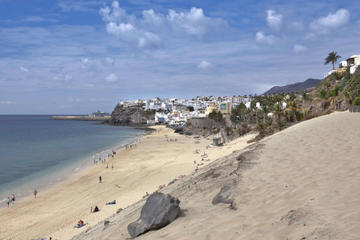
To the southwest of the centre, where the Son Bauló hotel and apartment belt ends, is La Platja de Son Bauló and, beyond the trickle of water from the Torrent de Son Bauló, the wilder Platja de Son Real. The latter is not kept as clean as the former, but it is worth walking along here for several reasons. This almost 5km stretch of coast, with snippets of sandy strands in among the rock points, is backed only by low dunes, scrub and bushland dense with Aleppo pines. Much of this area between the coast and the Ma12 highway, once private farmland, has been converted into the Finca Pública de Son Real . Its main entrance is just south of the Km18 milestone on the Ma12, and the ramshackle buildings of a once proud possessió (now being renovated) host an information office for those who wish to walk the property’s several trails. From the seaside, you can cross the fence at various points.
From the possessió, one trail leads through a largely abandoned fig plantation to the overgrown Talayotic ruins of Es Figueral de Son Real . This settlement dates at least to 1000 BC and consists of several buildings.
Greater visual impact comes from the Necròpolis de Son Real , on the sea about 10 minutes’ walk southeast of Platja de Son Bauló. It appears to have been a Talayotic cemetery with 110 tombs (in which the remains of more than 300 people were found). The tombs have the shape of mini-talayots and date as far back as the 7th century BC. Some suggest this was a commoners’ graveyard. Please don’t walk on the tombs.