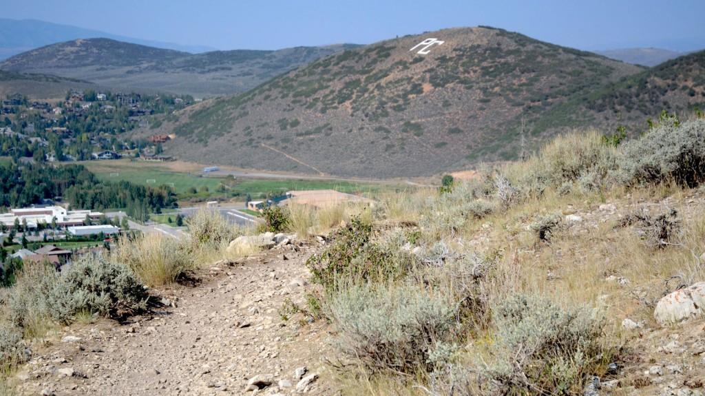
The Lost Prospector Trail in Park City. Photo © Mike Matson.
The trail is best hiked as a one-way excursion, parking a vehicle at both ends. From the small parking lot at Prospector Park, walk east along the paved path for 0.1 mile until it merges with the wider Rail Trail. Continue east on the Rail Trail for 0.6 mile. Despite the Rail Trail’s proximity to the Kearns Boulevard, an excellent wildlife-watching opportunity presents itself. Between the trail and the road several beaver ponds with a large beaver lodge can be easily spotted. Just before you cross the bridge, look for the brown flexi-pole sign marking the Skid Row Trail. Turn right at the sign following the dirt path into the woods. Skid Row hardly lives up to its ominous name. Winding up through a maple and oak forest, the trail switchbacks gently back and forth, slowly gaining elevation. Mountain bikers usually ride the trail and this is their descent, so be aware that they could come around a corner at any time.
At 1.3 miles the trail reaches a junction with a trail sign. Take the right fork here, following the sign for Lost Prospector. The trail levels off, having already done most of its climbing. The dirt path rolls up and down, traversing the ridge westward above Park City High School. At 2.4 miles you’ll reach another signed junction; continue straight to stay on the Lost Prospector Trail. Views open up 2–3 miles down to the high school and west toward downtown Park City. At 3.5 miles there is another trail junction; again continue straight, following the sign for the Lost Prospector Trail. This is the beginning of a beautiful stretch of trail through an aspen grove. At 3.8 miles views look down over Main Street to the ski slopes of Park City Mountain Resort. The trail ends at 4.3 miles on Aerie Drive.
It’s possible to make a loop trip out of Lost Prospector by descending Aerie Drive, turning left, and following Deer Valley Drive to the Rail Trail. Then turn right on the Rail Trail and follow it back to Prospector Park.
To the Prospector Park trailhead: From Salt Lake City drive east on I-80 for 27 miles to Exit 146 and merge onto U.S. Highway 40 headed east. Continue 3.8 miles to Exit 4 for Park City. Turn right off the exit ramp onto Kearns Boulevard and drive 1.7 miles. Turn left on Wyatt Earp Way and turn left again into Prospector Park (2500 Wyatt Earp Way).
To the Aerie Drive trailhead: From Salt Lake City drive east on I-80 for 23.5 miles to Exit 145 for Kimball Junction. Turn right off the freeway ramp onto State Route 224 and continue for 5.8 miles to Park City. Turn left onto Deer Valley Drive and drive 0.7 mile to Aerie Drive. Turn left on Aerie Drive and drive 0.2 mile to a small parking area on the right side of the road. The trail is across the street on the left side of the road.
There is no fee. Dogs are allowed on leash. A map of the trail is available at the town of Park City’s website. For more information contact the Park City Municipal Corporation, 445 Marsac, Park City, UT 84060, 435/615-5001.
Excerpted from the First Edition of Moon Take a Hike Salt Lake City.