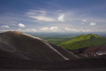
An extraordinary and easy day trip from Managua, Masaya, or Granada, Volcán Masaya National Park (9 a.m.–4:45 p.m. daily, $5) is Nicaragua’s most impressive outdoor attraction and premier tourist site. There are very few volcanoes in the world where you can simply drive up to the crater edge and look into what the Spaniards declared to be the very “mouth of hell”: That’s exactly what Masaya offers, but there’s a lot more. One of the most visibly active volcanoes in the country, Volcán Masaya emits a nearly constant plume of sulfurous gas, smoke, and sometimes ash, visible from as far away as the airport in Managua. From one of its craters, you can sometimes glimpse incandescent rock and magma. A visitors center (where they’ll ask you to park your car facing out “just in case”) will help you interpret the geology and ecology of the site, as will the park’s impressive nature museum. For the more actively inclined, hiking trails cover a portion of the volcano’s slopes.
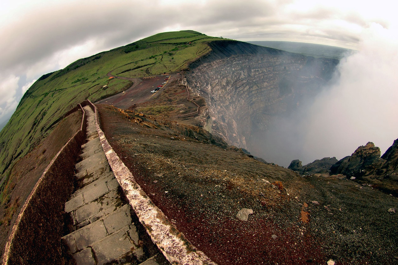
At the edge of Volcán Masaya’s crater. Photo © Andrea Santini/123rf.
Though most visitors only snap a few photos from the crater’s edge before continuing, the park also contains several hiking trails through a veritable moonscape of lava formations and scrubby vegetation…Volcán Masaya was called Popogatepe (mountain that burns) by the Chorotegas, who feared it and interpreted eruptions as displays of anger to be appeased with sacrifices, often human. In the early 1500s, Father Francisco Bobadilla placed a cross at the crater lip in order to exorcise the devil within and protect the villages below. Not long afterward, though, thinking the volcano might contain gold instead of the devil, both Friar Blas del Castillo and Gonzalo Fernandez de Oviedo lowered themselves into the crater on ropes to search. They found neither the devil nor gold, but probably singed their eyebrows.
The park is actually composed of several geologically linked volcanic craters: Volcán Nindirí, which last erupted in 1670, and Volcán Masaya, which blew its top in 1772. The relatively new Santiago Crater was formed between the other two in 1852, and is inhabited by a remarkable species of parakeet that nests contentedly in the rocky side of the crater walls, oblivious to the toxic gases and the scientists who had thought such a sulphurous environment would be uninhabitable. You might see these chocoyos del cráter (crater parakeets) from the parking area along the crater’s edge.
As for the sensation of “just in case,” the danger is quite real. In April 2000, the Santiago crater burped up a single volcanic boulder that plummeted to earth, crushing an unfortunate Italian tourist’s car in the parking lot.
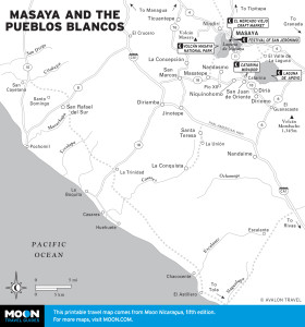
Masaya and the Pueblos Blancos
The exhibits at the Visitors Interpretation Center and museum include three-dimensional dioramas of Nicaragua and Central America, models of active volcanoes, and remnants of indigenous sacrifice urns and musical instruments found deep in the volcano’s caves; there is also a display of old lithographs and paintings of the volcano as the Spaniards saw it. Consider one of the several guided tours ($10 pp, sign up at the visitors center), including an exciting night tour beginning at sunset. Of special interest is the walk to the Tzinancanostoc Bat Cave, a lava tube passageway melted out of solid rock.
Though most visitors only snap a few photos from the crater’s edge before continuing, the park also contains several hiking trails through a veritable moonscape of lava formations and scrubby vegetation, making it easy to spend at least half a day here; carry lots of water and sunscreen (there is little to no shade); the trails are well worth your time and offer good opportunities to cross paths with some of the park’s wildlife, including coyotes, deer, iguanas, and monkeys. The Coyote Trail will lead you east to the shore of the Laguna de Masaya.
The peaceful waters of the Laguna de Masaya belie the violent origin of the lake. Long before the first Chorotegas settled in 20 small villages around its perimeter, the lake was one of Volcán Masaya’s gaping craters, choked off long ago by shifting channels of magma beneath the surface of the earth and abandoned to slowly fill up with rainwater. These days, the most impressive views of Laguna de Masaya are from the 100-meter-high vantage points of the malecón in the city of Masaya, or from the restaurants that line Carretera Masaya, just west of the city. It’s one of Nicaragua’s bigger crater lakes: 8.5 square kilometers set at the foot of Volcán Masaya and 73 meters deep in the center. It’s also one of the country’s most polluted with sewage and trash. While several trails, some of which were made by the Chorotegas themselves, lead the intrepid hiker down to the water’s edge, this is no swimming hole. Dip your heels in nearby Laguna de Apoyo instead.
Excerpted from the Fifth Edition of Moon Nicaragua.