Coast-to-Coast Walkway
TIME : 2016/2/22 12:10:58
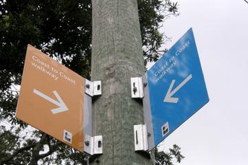
Coast-to-Coast Walkway
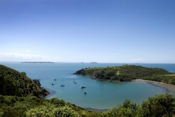
While you’d never know it unless you looked at a map, the city of Auckland—along with the Northland—is almost its entirely own island. In fact, on the city’s southern end, by the suburb of Otahuhu, the strip of land connecting Auckland with the North Island is narrow enough that ancient Maori used to portage their boats across it. At the narrowest point, less than three quarters of a mile separate Waitemata Harbor from the harbor at Manukau, and even at one of its widest points, the Auckland Isthmus is still narrow enough to be crossed on foot in a day. On Auckland’s famous Coast-to-Coast Walkway, ambitious visitors can walk 9.6 miles between the yacht-lined slips of Viaduct Harbor to Onehunga Bay Reserve. In doing so, hikers begin on the Pacific Coast at Waitemata Harbor, and finish along the Tasman Sea at the harbor at Manukau. For the sake of comparison, the trip by boat would require 600 miles of sailing around Cape Reinga—just to reach the same place you could walk in under 10 miles. The enormous, land-based shortcut aside, the Coast-to-Coast Walkway also offers a thorough tour of Auckland, from the open lawns of Auckland Domain to the sweeping views from Mt. Eden. Stroll through tree-lined Cornwall Park and climb up One Tree Hill, and experience Auckland’s many suburbs that stretch from coast to coast.
Practical Info
The Coast-to-Coast Walkway is part of Te Araroa that spans the length of New Zealand. Many travelers will pick up a map at the I-Site in Princes Wharf, and then catch a train or bus to Onehunga to start the walk back to Auckland. Food, water, supplies, and restrooms can be found along the trail, which is well marked and begins a short distance from the Onehunga station.