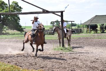
Lapataia Bay
TIME : 2016/2/22 9:14:51
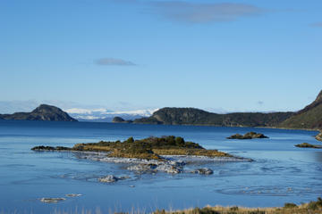
Lapataia Bay
Lapataia Bay is where Argentina’s RN 3 road ends, a road that is a continuation of the Pan-American Highway, which stretches all the way to Alaska. Roadies are always stopping to pose next to the sign here in Lapataia Bay, and it’s worth thinking about how far they’ve come to get there! According to the sign, the distance between this spot and Alaska is a whopping 11,090 miles (17,848 kilometers). Most visitors don’t take the land route to Lapataia Bay, however, and instead fly into Argentina. The bay is within Parque National Tierra del Fuego, a popular day trip from Ushuaia, which sits only 10 miles away. The park offers a chance to get out into nature, overlook azure lakes and bays, walk through native beech forests and in season, catch both the firebush, which blooms bright red, and the spooky-looking orange “pan de indio,” golf ball-sized mushrooms that grow on some of the trees.
If you have more time, try out some of the other trails in the park, which covers almost 150,000 acres of this island off the southernmost tip of the South American mainland.
Practical Info
To find the bay in the park, hike the tranquil Senda Costera (coastal trial) from Bahía Ensenada for about six hours, with views of nearby islands and soaring peaks in the distance. If that’s more time than you have or more walking than you’d like, book a two-hour boat trip from Bahia Ensenada to Lapataia Bay instead. Reservations are recommended.