Norway’s Kystriksveien (Coastal Way) is that journey.
The Kystriksveien can begin much further south, but it is in Sandnessjøen, with its name that echoes the epic sagas of Old Norse myths, where the journey begins in earnest. Sandnessjøen is, truth be told, a slightly scruffy settlement, but its location provides the first glimpse of the elemental contrasts that lie ahead.
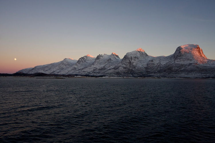
Out to sea, islands, among the 14,000 that line this stretch of coast, lie scattered in the deep blue waters of the North Atlantic. Rising up behind the town to the south is the Syv Søstre (Seven Sisters) range of mountains, a seven-peaked fortress of rock and ice; fit hikers can climb all seven peaks (ranging from 910m to 1072m in height) in a single, albeit very long day. To the east, fjords cut deep gashes into the Norwegian interior in a snapshot of the country’s deeply fissured coastline.
Leaving Sandnessjøen, the road twists and turns, at times in a gentle meander, at others bucking and weaving across a jagged terrain between the ocean and the mountains whose summits remain flecked with snow even into summer.
And then, at the village of Låvong, the road ends, as it so often does in Norway, at the water’s edge. Here you must wait until, in time, a ferry appears to connect you with where the road resumes at Nesna. Soon enough, once again, the road resumes its journey up mountain and around fjord.
It is a rhythm that will soon become familiar, for this is a road drawn across an impossible topography, where ferry crossings - imposed rest breaks, necessary pauses to wait and reflect – join the dots.
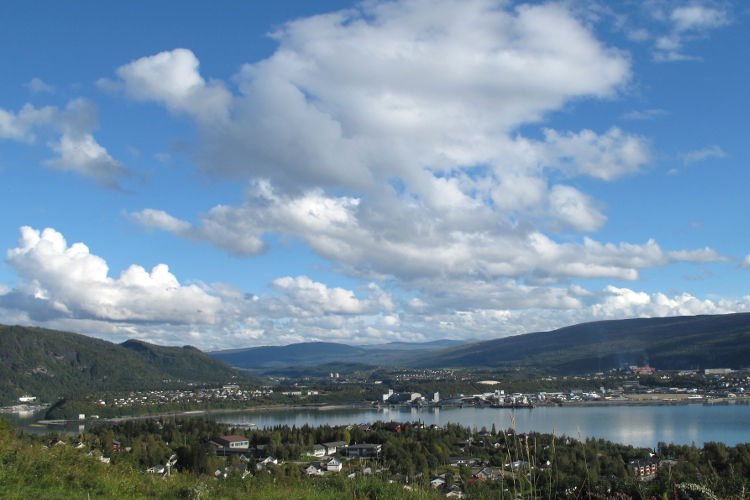
Hugging the southern bank of Ranafjord, the road draws near to Mo i Rana, an important regional city, before pulling away, shadowing the shoreline, heading west and then north. Unlike what came before and what lies ahead, the scenery is less spectacular than really rather pretty – waters lap gently at pebbled beaches, meadows of vivid green rise to where the treeline ends and wooden cabins painted in oxblood red jut out over the water.
 Mo i Rana. Image by Pets & Paintings / CC BY 2.0
By Stokkvågen, the tight interplay between coast and mountain – the true source of the Kystriksveien’s charm – has again become dominant. Not far to the north, concrete rubble is all that remains of the Nazi coastal fort of Grønsvik, one of more than 350 defences constructed along Norway’s coastline during WWII. Overgrown and functionalist, it is at once an aesthetic aberration and a reminder of human ideologies that ought have no presence amid such beauty. Order is restored around 1km further north at a lookout from where views look out into eternity.
Somewhere on the hour-long ferry crossing between Kilboghamn and Jektvik, the boat cross the Arctic Circle. There is no fanfare, no avuncular voiceover from the captain. In truth, by this stage of the journey, it scarcely seems to matter. The Arctic spirit – that spare, pure light of snows, that world in which humans seems somehow overwhelmed – has long ago taken hold.
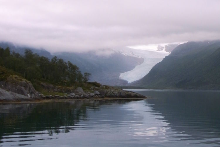
Veterans of this route have been heard to argue that the further north you travel, the more spectacular the visual offerings. And who could argue when the road passes more islands, islets and skerries than you can count out to sea, while spring wildflowers or deep snows carpet the earth as sea eagles circle high above? Beyond the Ågskardet-Forøy ferry, the glaciers of the Svartisen ice sheet emerge from the Svartisen-Saltfjellet National Park with a gravitas that only glaciers carry; the ice sheet is Norway’s second-largest glacier and glacial tongues arch down off the frozen uplands, down into the waters of Holandsfjorden like waterfalls frozen in time.
If you’re tempted, a ferry crosses the fjord from the tiny hamlet of Holand, a suitably humble human gateway to the national park’s western realm. From the jetty on the far side, a 3km gravel track unfurls the tip of the Engebreen glacial tongue.
By the time you reach the improbably broad sandy Arctic beach at Storvik, 100km south of Bodø, the land has begun to flatten, but it is by no means the end of the Kystriksveien’s stirring natural phenomena.
Some 32km south of Bodø, in the 3km-long, 150m-wide Saltstraumen Strait, the tides of two fjords drain into each other four times a day, causing the Saltstraumen Maelstrom that looks for all the world like a waterfall at sea. Said to be the world’s largest such maelstrom, it’s an utterly compelling spectacle, especially if viewed from the shoreline or from the Saltstraumbrua bridge which overlooks the strait at its apex.
This extraordinary sight is a fitting end to an extraordinary journey. It is a journey that ends in Bodø, where ferries cross to a similarly beautiful Arctic land mass, the Lofoten Islands. These islands, whose otherworldly rocky outcrops emerge from the sea like some forbidden Arctic kingdom, loom out across the water, promising another route of escape as you return to the world of human civilisation.
Hotel Sandnessjøen Covers major attractions, transport info, as well as places to stay and eat.
Bodø Tourist Office Useful for timings of the Saltstraumen Maelstrom.