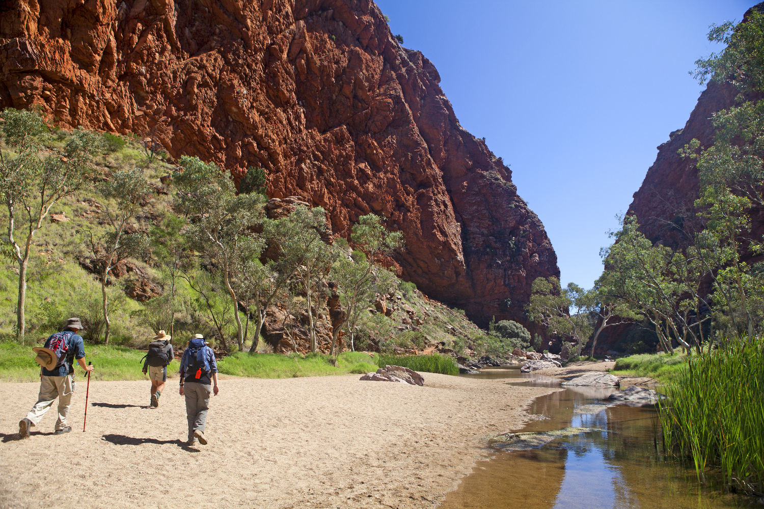
The Larapinta Trail, a 223km hike through the West MacDonnell Ranges outside of Alice Springs, is famed among walkers the world over, but the Larapinta isn't the only reason to bring your hiking boots to the Northern Territory.
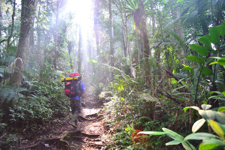
Covered with desert mountain ranges, seemingly endless floodplains, ancient Aboriginal rock art and a host of thundering waterfalls, the Northern Territory offers a classic Australian experience on foot. Throughout the Territory's national parks there are walking trails – short and long – that bring this stark land into the kind of finely detailed perspective you just can't get hopping between sites in a vehicle.
Walking here is very seasonal and largely confined to winter and the dry season (around May to September). Walking tours run by groups such as World Expeditions, Australian Wilderness Adventures and Australian Walking Holidays are a good way to approach the trails here with the right equipment and support.
At the mouth of Katherine Gorge, in Nitmiluk National Park, there's invariably a flurry of activity as tourist boats and canoes splash towards the gorge, but it's also here that the Jatbula Trail sets off on a very different journey.
This 66km walk heads away perpendicular to the gorge, running along the line of the Arnhem Land escarpment, first at its base and then, for most of the five or six day hike, atop it.
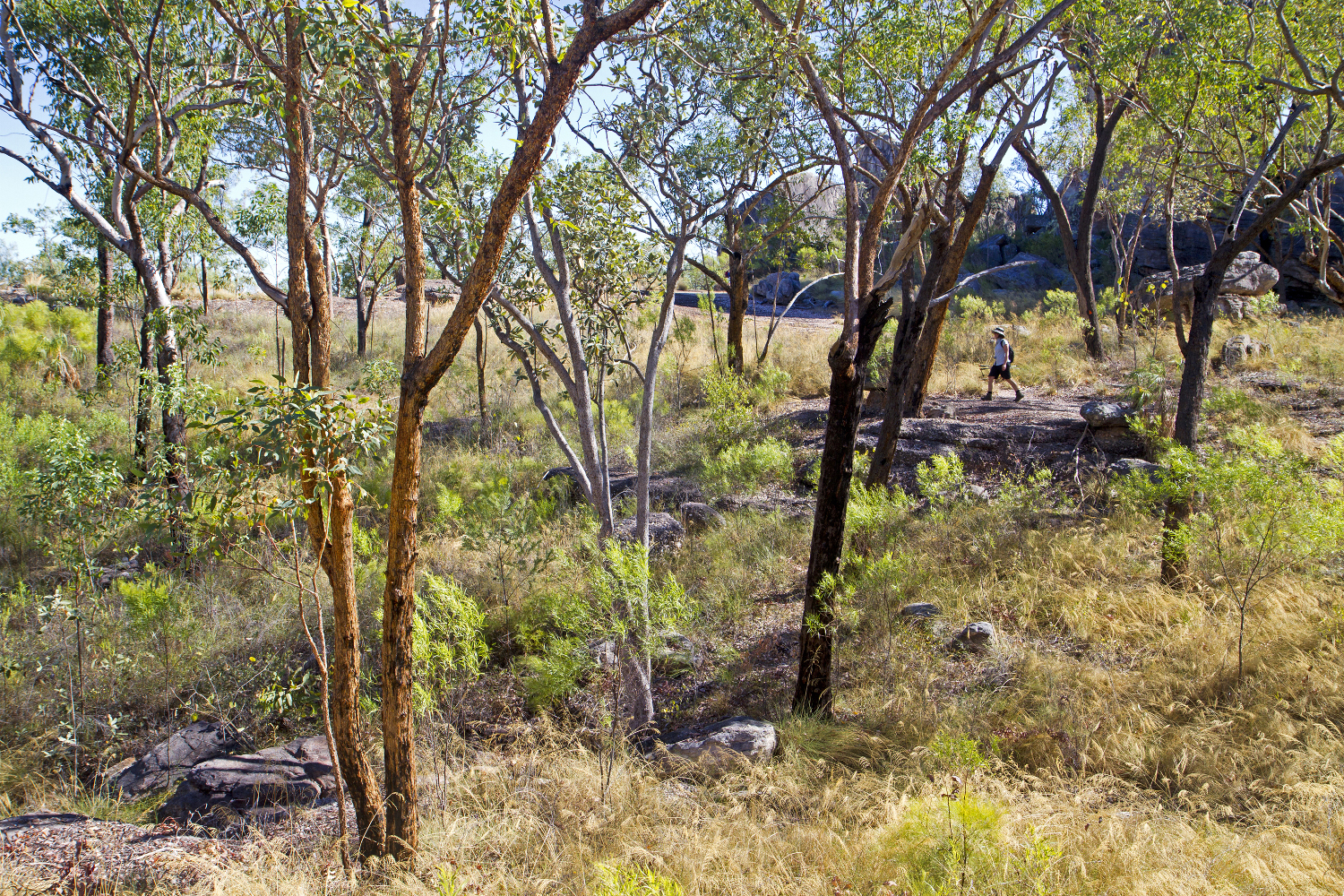
For most of its length, the trail heads through the savannah grassland that defines so much of Australia's Top End. Termite mounds rise like blades above the tall speargrass, and the exposed rocks are as red as a heart. Set it all among yellow grasses, beneath a perpetually blue sky, and it's a classic Australian outback palette of colour.
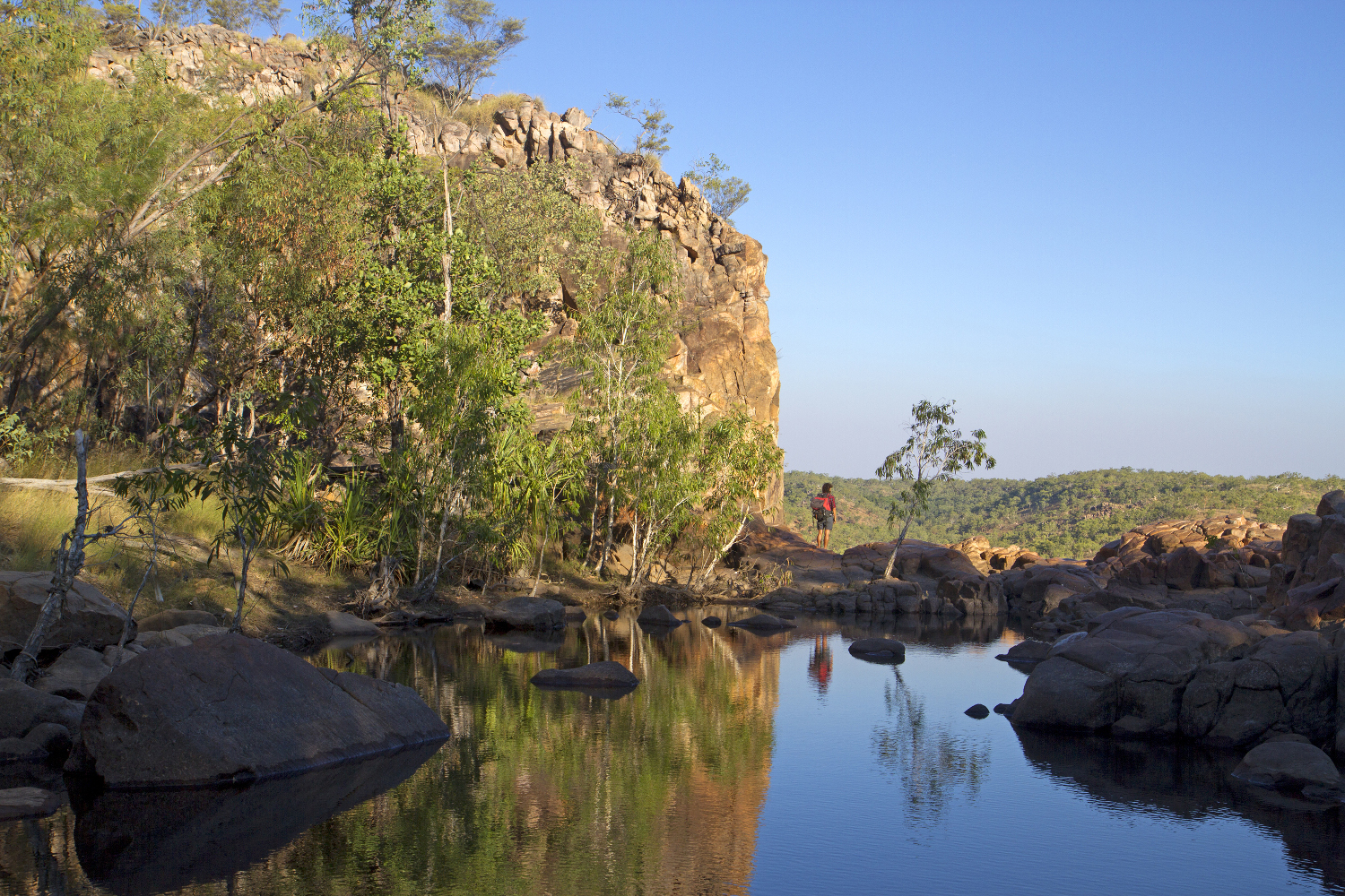
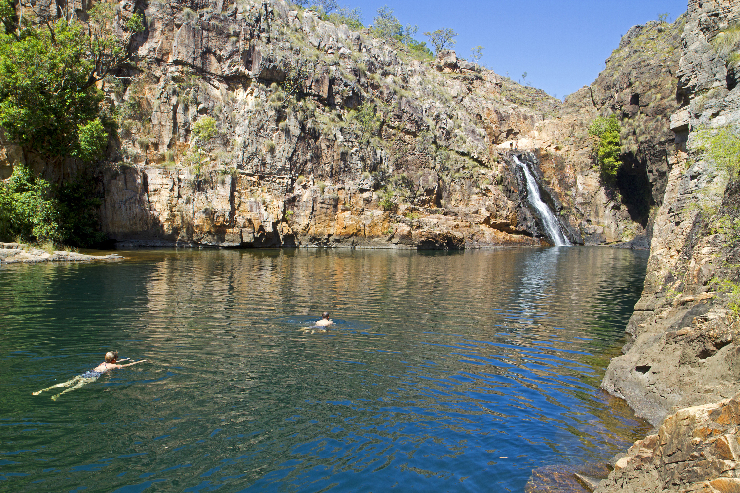
The most striking and welcome features along the Jatbula Trail are the campsites. Each day ends beside water – running streams, waterfalls, or a lagoon-like section of the Edith River. The camps can only be accessed by walking the trail, effectively creating private plunge pools for hikers to soak away the heat and effort of the days on the trail.
The campsites are at places of enormous beauty, from rockpools perched at the edge of 30m-high 17 Mile Falls, to the mirror-flat waters at the well-named Sandy Camp.
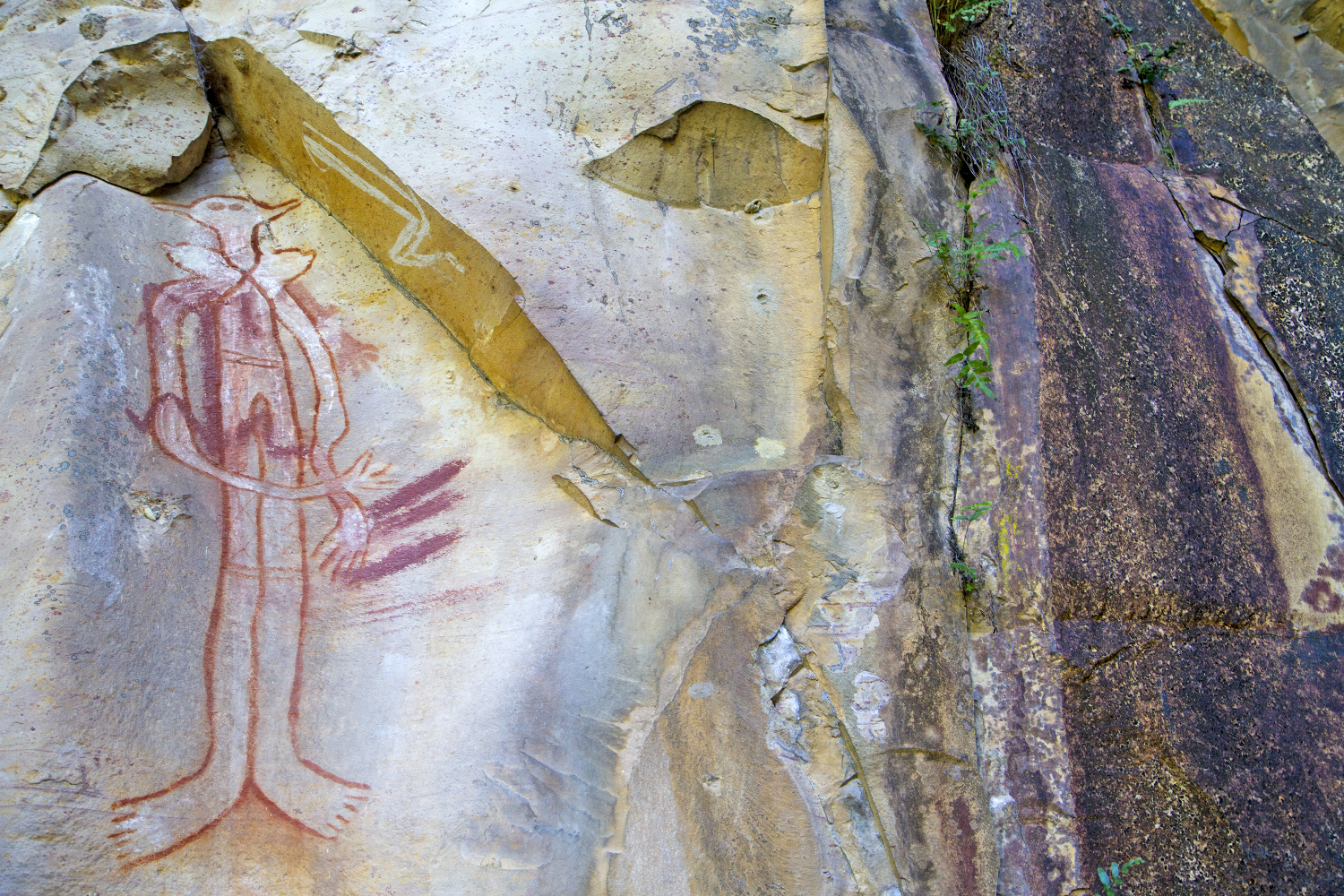
About an hour before 17 Mile Falls – pretty much halfway along the Jatbula Trail – is another private treat for hikers: the Amphitheatre. This cool, shaded gorge, slotted into the escarpment, shields one of Nitmiluk National Park's finest Aboriginal rock-art sites, featuring ochre images of the Jawoyn people and emus.
Days on the Jatbula Trail are invariably hot, but they needn't be long, with campsites spaced between 11 and 16 kms apart. Set out around dawn each day and you can be in camp by lunchtime, sitting out the heat of the afternoon in a stream or pool.
Make it happen
The Jatbula Trail can be hiked with World Expeditions or independent bookings and information can be found on the NT's Parks & Wildlife website .
North of Nitmiluk is Australia's largest national park, Kakadu, covering an area almost the size of Israel. Although daunting in scale, it's a great bushwalking destination.
Overnight walks in Kakadu are unmarked and there are no set routes, though they typically head into the so-called 'stone country' atop the Arnhem Land escarpment. Hiking requires permits – applications need to include details of the proposed walking route, the location of each night's campsite, and a marked-up topographic map. Despite the regulations, parks authorities reported a large increase in applications for overnight walks in 2014.
The rewards of hiking into the stone country are multiple, with an estimated 15,000 rock-art sites – most unmarked – dotted through the park. Around one-third of Australia's bird species have been recorded in Kakadu and, up here, above the cliffs, there's a true sense of isolation and exploration.
Even if you can't venture deep into the park, Kakadu has about 25 marked day walks around and below the escarpment.
Most of the day walks are framed around water, since even in the middle of winter the average maximum temperature in Kakadu is around 32°C. Trails head through savannah woodland to waterfalls, gorges and crocodile-free swimholes, where fish swirl around your feet and water monitors (or goannas) might watch from the rocky banks.
Good day walks include little-visited Motor Car Falls (ironically accessible only on foot), where you can swim into a large crack in the cliffs, and a steep but short trail to the head of Gunlom waterfall, where a natural infinity pool ends abruptly by the very edge of the escarpment.
The 12km Barrk Sandstone bushwalk offers a different perspective – no water, but a look at some of Kakadu's premier rock-art sites as it traverses Nourlangie Rock, an outlier of the Arnhem Land escarpment. Further along, at the base of Nourlangie Rock, there's an easy 3km trail into Gubara Pools, a crystal-clear swimhole shaded by monsoon rainforest.
Make it happen
All day walks are detailed on Kakadu's park website . Australian Walking Holidays , Australian Wilderness Adventures and World Expeditions run guided hikes.
For all of the Northern Territory's well-known walks, there's another trail still to emerge into the spotlight. The Tabletop Track is a 39km-circuit inside Litchfield National Park, where waterfalls seemingly pour from every break in the cliffs of the Tabletop Range.
Taking most walkers between three and five days, the Tabletop Track remains a little-known route, despite being established for years. It's a spectacular trail, passing the likes of Florence and Wangi Falls, two waterfalls that have helped turn Litchfield into perhaps the most popular national park among Top End locals.
Make it happen
An information sheet on the Tabletop Track can be downloaded at the Litchfield National Park website .