The entire Ryukyu Island chain, starting below Japan’s main island of Kyushu and running all the way to Taiwan, is about the only area of Japan that affords their citizens a good look at this interesting part of the Mangrove bio-world. Many thanks to Okinawa Soba for posting this description and photo journey of Mangroves in Okinawa. The complete set can be found on flickr at Dedicated MANGROVES of OKINAWA Set : www.flickr.com/photos/okinawa-soba/sets/72157640998981863… . You can also read about a kayak day trip from Naha in Okinawa to the Yanbaru Mangrove Forest here and a little more on the Yanbaru Magrove Forest here.
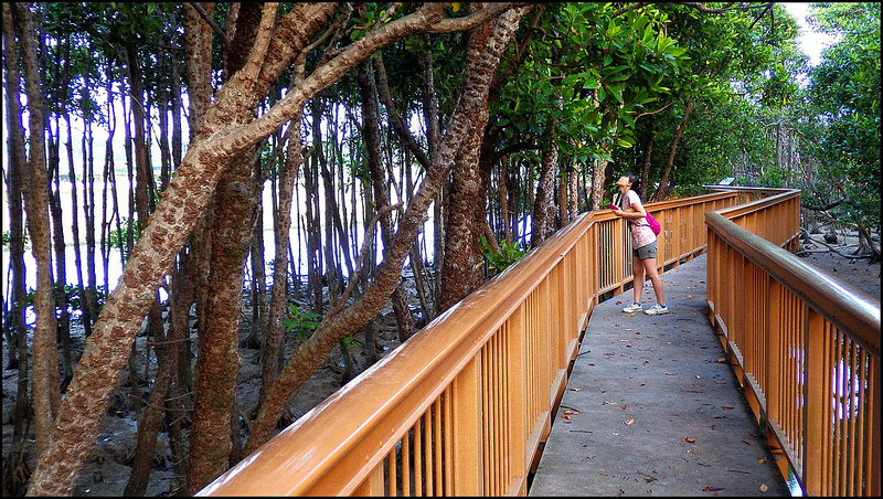
Mangroves of Okinawa walkway
With annual tourism to Okinawa Prefecture is now topping 6 million visitors a year, the mangrove swamps (or if you will, the mangrove forests, or the mangrove biome), have become an important part of the “eco-tourism” industry that’s grown up around Okinawa’s tropical Jungles, Rainforests, and Coral Reefs.
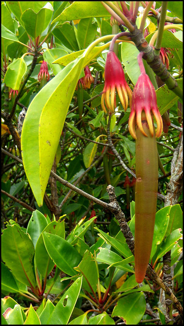
The Typical Hanging Flower and “Fruit” of a Mature Mangrove
“……All mangroves flower but some don’t produce seeds which fall off like other plants but rather ‘live plants’. The fertilised seed develops into a seedling while still attached to the flower. The seedling is merely a long, cigar shaped ‘stem’ (called a propagule) and this grows for up to a year on the tree before it is ready to find a place of its own to grow.
When it reaches about 20 cm (8 inches), depending on the species, it drops off and is carried by the tide. These seedlings are often washed up onto tropical beaches. If the seedling gets carried into brackish water shallows (part fresh, part salt water) and is lodged into a muddy bottom, roots are quickly sent out to take hold in the soil and the stem grows upward and produces leaves……”
Text source: www.wettropics.gov.au/mangroves-info
Okinawa Prefecture’s most spectacular and expansive Mangrove areas (accessible for exploration by Kayak) are on the Island of IRIOMOTE. However, for the sake of this set, the focus is on the populous main island of OKINAWA proper. For the most part, getting close to Mangroves involves Kayaking through the estuary swamps during high tide, or observing from raised walkways built for the purpose.
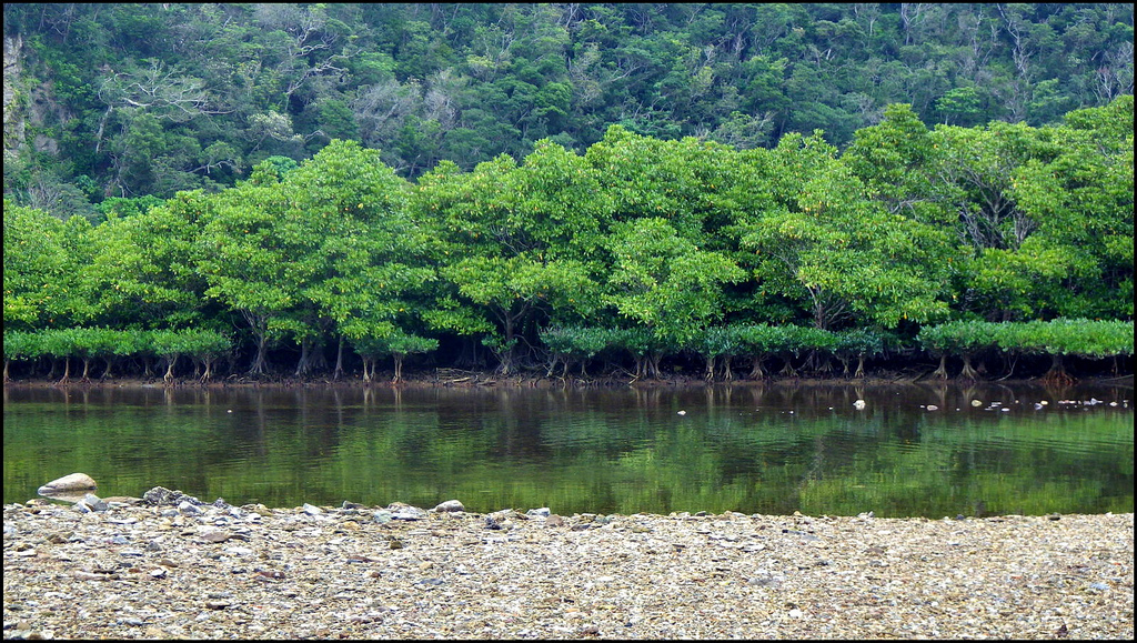
Layers of Tree Growth on the South Bank of the OURA RIVER
Another visually layered photo for your consideration.
Notice the easy-to-cross, rock-and-sand river-bed along the foreground shores of the OURA RIVER along Route 18.
Depending on time of year, and how successive river flows after storms and typhoons have changed the river bed, you can usually find safe, hard-bottomed shallows to slosh across to get to the Mangroves — with absolutely NO dangerous or mucky “Mangrove Mud” in which to find yourself trapped and slowly sinking !
Interestingly, the far bank is where the sand and stones quickly change to mud and silt. Test your footing as you make your way through some gaps in the trees (off frame here). Call it quits and back off if you start sinking into the mud.
The reason for the “don’t-walk-here” approach is the general “soft mud” environment that prevents you from actually strolling through the trees as you would in any other forest or botanical garden. Further, the soft mud around the roots and between the trees is home to a bio-diverse world of (among other things) various crab, crustacean, and mud-skipper populations that would get trampled on.
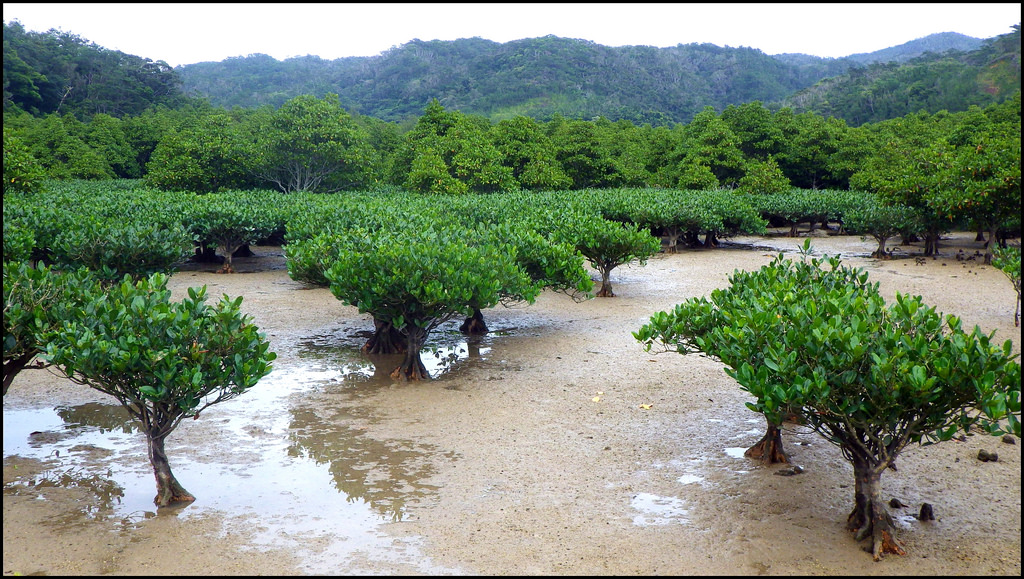
Where a Supportive Sand-and-Gravel River-Bed Quickly Changes to Dangerous Mud beside the OURA RIVER
Here you can see how young trees on the muddy tidal flats lead back to an older and denser Mangrove Forest.
Some spots might even get a good “quicksand” grip on you if you decide to go in anyway.A rare exception to this sticky, gooey, mud situation (at least the best one I’ve found so far) is found along Route 18 near the east-coast Village of OURA, just north of Camp Schwab.
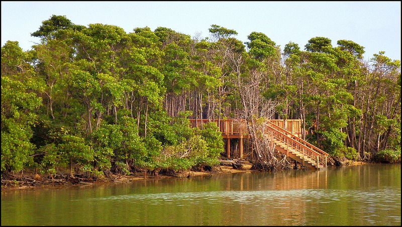
Mangroves of Okinawa walkway to river
Here, at low tide, you may walk across the hard-packed, sand-and-pebble bed of the OURA RIVER, and ford a couple of shallow pools and fresh-flowing rivulets to examine first hand the intricate beauty of the trees, roots, flowers, and leaves — without sinking into the unforgiving mud and slime found at most other Mangrove attractions. Bring your camera, and have no fear.
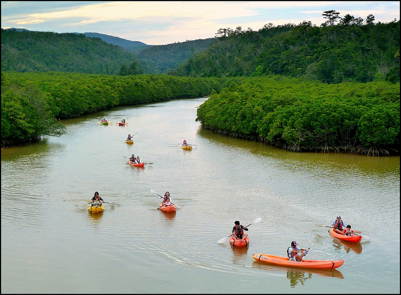
Returning to the Mouth of GESASHI RIVER After a Day of Adventure
Taken about 4 PM with clouds overhead on nice day in May. Here you have the last Mangrove exploring group of the day bringing in their Kayaks. Soon, they will be making the drive home (or to their hotel), and, after a good meal, kick back for the evening while giving their tired arms a good rest ~ !.
Keep in mind that this applies only to the Mangroves bordering the river itself. The deeper you walk into the trees on the far side of the river, the fortuitous mix of river-sand and mud that keeps you from sinking in gradually becomes more mud than sand… and, things might get a bit scary if you start to sink into it!
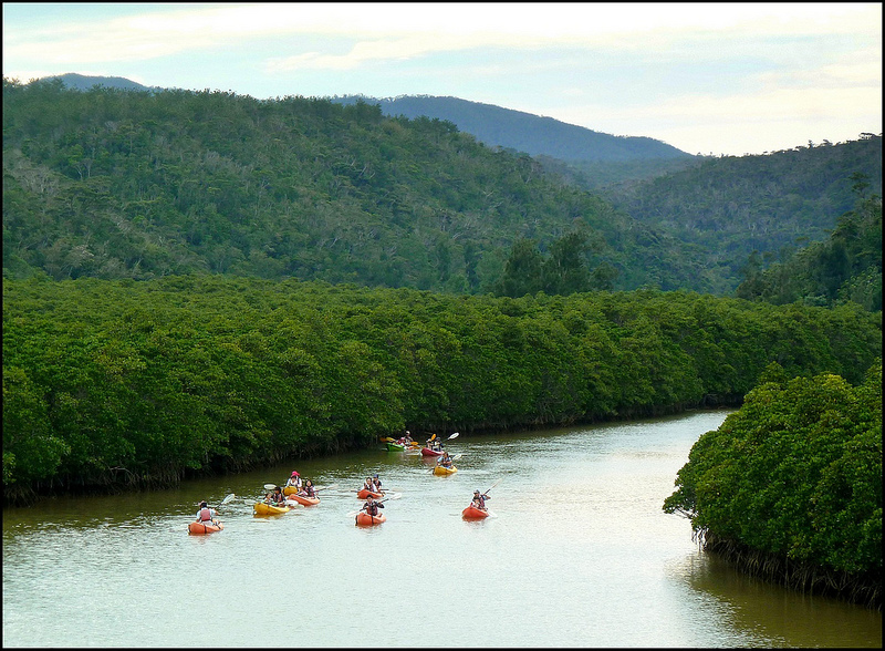
Mangroves of Okinawa kayak journey 2
Some of these pretty spots along the OURA RIVER, as well as some Mangrove Forests in KIN and GESASHI Village are captured here. However, for those on Okinawa’s main island who only have time for a day trip (that might include young kids up for some adventure), you can still get your fill of raw nature and exploration (by foot or by boat), and make it back home in time for a good night’s sleep.
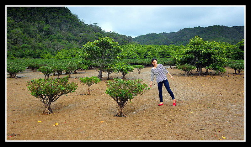
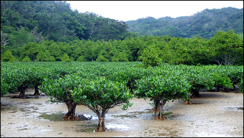
Young Trees Lead Back to Older and Denser Mangrove Forest
We have just waded across the clear shallows of the OURA RIVER to get to this spot. The supportive sand-and-gravel river-bed has suddenly changed into the low-tide mud flats the the Mangoves love.
Fortunately, there is enough sand mixed with the mud that we can walk back a little father without sinking in. Going back beyond the two larger trees seen behind the young lady is probably not a good idea…especially if you are alone. I’d hate to find myself waist deep in mud, and unable to call for help or extract myself when the tide starts coming in.
All of these Mangrove images are posted with Creative Commons permission by Okinawa Soba at Flickr, thank you so much!
Mangroves of Okinawa young trees at base of hills
More about the important world of Mangroves is found HERE :
♥ en.wikipedia.org/wiki/Mangrove
♥ oceanservice.noaa.gov/facts/mangroves.html
♥ ngm.nationalgeographic.com/2007/02/mangroves/warne-text/1