Bay of Kotor
TIME : 2016/2/22 12:03:30
Bay of Kotor
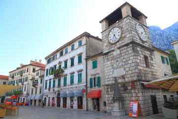
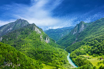
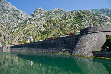
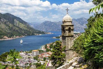
Running from Herceg Novi to Klinci in a virtual circle off Montenegro’s indented Adriatic coastline, the Bay of Kotor (Boka Kotorska or simply ‘Boka’) is a fjord-like inlet that wraps itself around the ever-higher mountains of the Dinaric Alps as it creeps inland, folding in upon itself in a series of bays before passing through the narrow Strait of Verige and splitting into two fat fingers. Strictly speaking it is a ria – a sunken river valley created after the Last Ice Age – and is 17.5 miles (28 km) in length, although its indented shoreline weaves through craggy landscapes for more than 67 miles (107 km). The bay is bordered by some of Montenegro’s most fascinating towns, from the fourth-century Roman remains of Risan to the medieval beauty of Old Town Kotor and the Venetian
palazzi of Perast, all touched culturally and architecturally by the many different empires that have put down roots here. Mountain bikers flock to the rugged hills around the shoreline; the bay’s myriad coves and beaches are perfect bases for sailing, kayaking and paddle boarding adventures; and frequent trip boats run out to the twin pilgrimage islands of Our Lady of the Rocks and St George from Perast.
Practical Info
The Bay of Kotor is on the Adriatic coast in southwest Montenegro. A narrow, winding road leads around the entire bay, passing through its many towns and villages; a car ferry runs between Lepetane and Kamenari in the Strait of Verige (journey time five minutes, ferry tickets cost €4 per car).