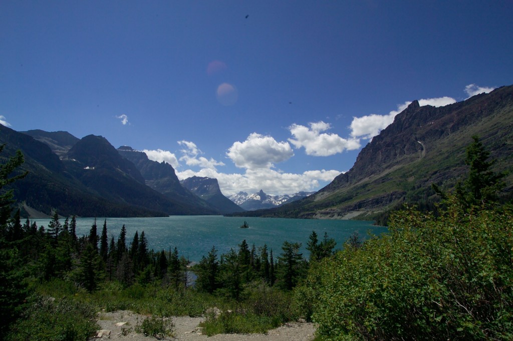
Wild Goose Island Overlook. Photo by David Restivo, NPS licensed Creative Commons Attribution.
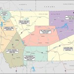
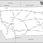
Montana is a big state, but for those who don’t mind doing some driving, it’s possible (indeed, exhilarating) to do a wide-ranging tour. Expect this Tour de Montana to take the better part of two weeks. If you really want to explore any particular area, add more time.Start your trip in Missoula, northwestern Montana’s cultural hub and an easy place to land. From there, a trip north up the Mission Valley, home of the Flathead Reservation, brings you to Flathead Lake, the largest freshwater lake in the West. Stay in tiny Polson, bustling Bigfork, or Whitefish, the region’s recreational capital, then head east for a tour of Glacier National Park.
Your best bet (at least during the summer) is to drive through the park on the Going-to-the-Sun Road. Even a relatively deliberate drive along this road can take all day, so plan to either spend at least one night in a park lodge or in one of its eastside border towns, St. Mary or East Glacier.
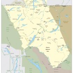
From Glacier National Park’s eastern edge just south of St. Mary, you can see the striking Rocky Mountain Front as you travel south along Highway 89. It’s about 140 miles from St. Mary to Great Falls, where visits to the Lewis and Clark National Historic Trail Interpretive Center and the C. M. Russell Museum will easily fill a day or two.
Then it’s just over 100 miles east on Highway 87 to Lewistown, which is small enough to give you the flavor of eastern Montana life. Lewistown is surrounded by places to hike, fish, or explore (including ghost towns and the Missouri River badlands).
Head southeast to the “big” city life in Billings. Spend the night if you like (there’s a vibrant bar and brewpub scene here), or continue about 60 miles southeast from Billings on I-90 to the Little Bighorn National Monument and the spectacular Bighorn Canyon.
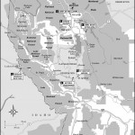
Turn back west on I-90, and at Laurel turn south on Highway 310 for about 10 miles, then southwest on Highway 212 for about 30 miles to Red Lodge, at the base of the Beartooth Highway. Plan to spend a day driving this winding road up to Yellowstone National Park, where you can stay as long as you like and never run out of places to explore. Though it’s only 120 miles from Red Lodge to Gardiner via the Beartooth Highway (Highway 212), it’s an all-day drive.
When it’s time to leave Yellowstone, ease your transition by staying about 25 miles north of the park at Chico Hot Springs. After a morning soak and hearty breakfast, travel north on Highway 89 for 25 miles to Livingston, which is a quirky hybrid of old and new West, with atmospheric old bars and high-end art galleries sharing Main Street.
Just 26 miles west of Livingston on I-90 is Bozeman, home of Montana State University and the Museum of the Rockies (a dinosaur lover’s must-see).
Stay on I-90 west as far as Three Forks (30 miles west of Bozeman), where at the Missouri headwaters, Lewis and Clark had to make some tough travel-planning choices. (As do you—if you’re running short on time, take I-90 west 173 miles back to Missoula.)
To continue an exploration of Montana’s heritage, head south 61 miles on Highway 87 to Virginia and Nevada Cities, where frontier-era buildings have been preserved, and there’s a visceral sense of the ruggedness of gold-rush towns. For a true ghost town that’s remarkably well preserved, don’t miss Bannack, just south of Highway 278, west of Dillon and about 80 miles from Virginia City, on the edge of the expansive Big Hole Valley. From the Big Hole, follow Highways 278 and 43 west over Chief Joseph Pass, and stop along Highway 43 about 60 miles west of Bannack to visit the Big Hole National Battlefield, where the Nez Percé, fleeing their Oregon homeland, were attacked by the U.S. Army.
Once you reach the Bitterroot Valley, it’s an easy day’s drive (about 100 miles north along Highway 93) back to Missoula.
Excerpted from the Eighth Edition of Moon Montana.