The sparse human population means the roads are almost empty, and the long, arrow-straight tarmac and major gravel sections are navigable with regular 2WD rental sedans, as is Etosha National Park, one of Africa's greatest wildlife safari destinations. Sturdy 4WD rentals are also reasonably priced, and they not only give a smoother ride, but they also open the door to more remote regions. There is a wide range of accommodations throughout the country, from stunning remote campsites to luxurious lodges and tented camps, so all budgets are catered for. If camping, mixing in a few comfortable lodgings along the way is a great idea. So, book yourself a vehicle and put together your own self-drive safari with this sample two-week itinerary.
Start in Windhoek, a modern African capital of high-rises and shopping malls that carry imported South African brands. After picking up the rental car or 4WD (don't wait to book until arriving in the country), hit a supermarket to stock up on supplies before heading north for the 280km drive to Waterberg National Park. If spending the night in town (and not a vegetarian) dine at Joe's Beer House, a legendary restaurant that serves succulent cuts of ostrich, springbok, oryx, gemsbok, crocodile and kudu.
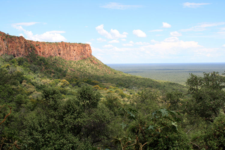
The 200m-high red sandstone bluffs of the Waterberg Plateau rise out of the landscape and stretch for 50km – it is visible from miles around. The plateau is largely inaccessible – except on foot – so it is home to a variety of endangered species, such as roan and sable antelopes, as well as rare flora such as the magnificent karee and the weeping wattle trees. Pick-up maps in the visitor centre for the many self-guided trails, or arrange guided hikes at Waterberg Camp, which is situated at the base of the plateau. Once on top, the views down are spectacular. The sweeping plains that stretch out below look like an undulating sea, punctuated with rocky islands. If camping, pack up well before going to sleep as baboons will scavenge during the night. The research and education centre for the world-renowned Cheetah Conservation Fund is also nearby, outside of Otjiwarongo. Also nearby is Okonjima, the home to the AfriCat Foundation , which sponsors a cheetah and leopard rehabilitation centre. Guests are able to participate in cheetah- and leopard-tracking (including on foot) expeditions.
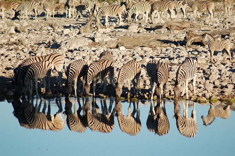
Home to 114 species of animal, including the largest population of black rhino in the world, Etosha is one of Africa's premier wildlife parks. It sits 300km north of the Waterberg National Park and, unlike many African parks it is not dense with vegetation – Etosha, meaning 'place of dry water', is a huge 5000-sq-km calcrete pan. During the drier months, between June and November, the waterholes attract large herds of animals, and you are virtually guaranteed to see incredible concentrations of wildlife. You can easily spend several days between the park’s three main camps – Namutoni, Halali and Okaukuejo – all of which have great flood-lit waterholes for viewing through the night (guided night drives are also on offer if you are staying at these camps). The previously inaccessible western portion of the park opened in 2014 and is accessible through Galton gate. It's easy to get around the park in a 2WD as the gravel roads are easy to drive, and a speed limit of 60km/h is strictly enforced.
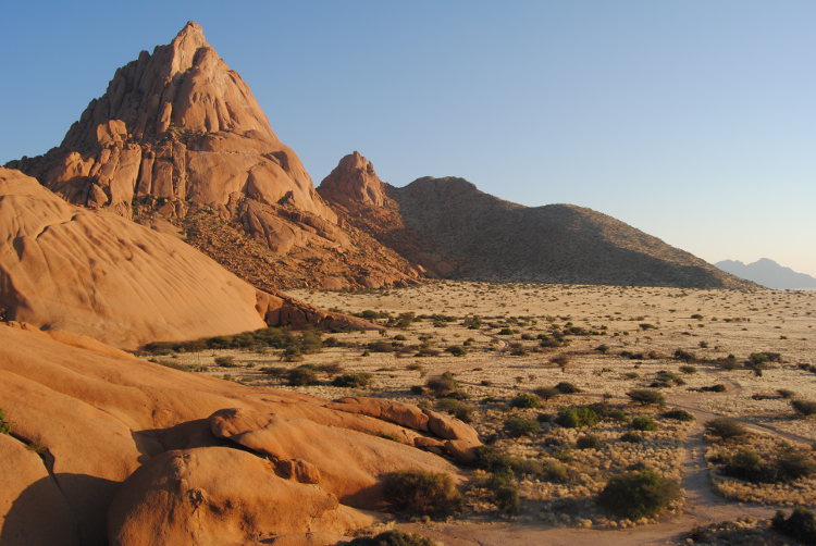
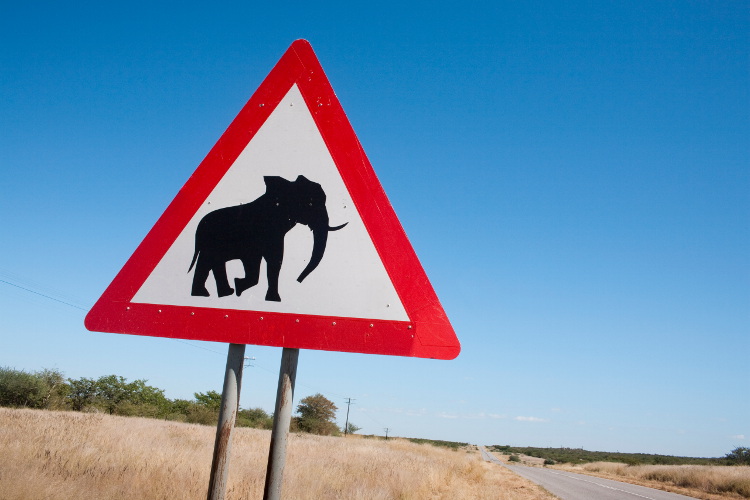
Leave Etosha via the main Anderson gate near Okaukuejo Camp and head westwards into Damaraland, a region of rumpled escarpments, dry river valleys and ancient volcanic peaks that descend from the Hoanib River in the region’s northeast to the seaside town of Swakopmund. Although the area is not a designated park, it is zoned into private reserves that support most of Namibia’s large wildlife species, including the elusive desert-adapted lion and elephant. The area is also rich in the rock engravings and artwork of the indigenous San people, most notable of which are the “White Lady” at Brandberg, Namibia’s highest mountain, and the 2500 petroglyphs at the Twyfelfontein valley which are 2000 years old. Further south is Spitzkoppe, the 'Matterhorn of Africa'. Its rounded granite peak towers 700m over the Namib plains like a mirage on the horizon and is visible from great distances. It is a rock climbers haven and a surreal place to camp.
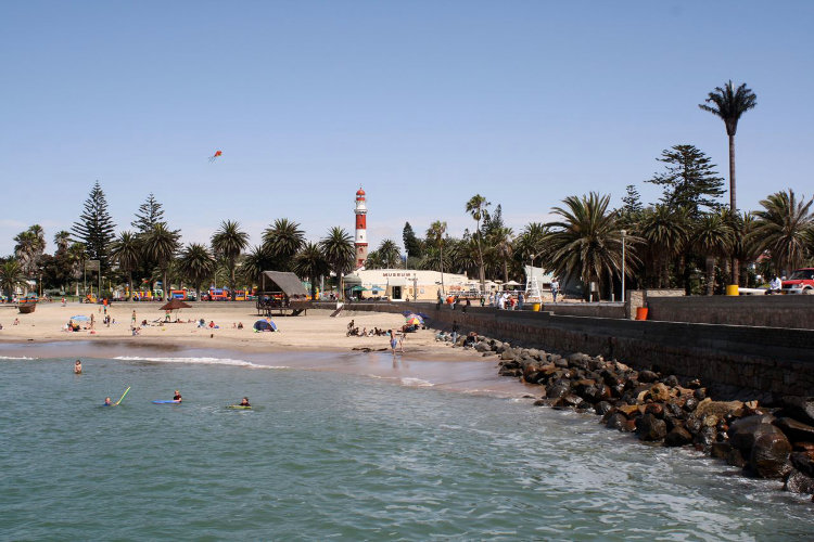
After a week on dusty desert roads, arriving at the seaside in Swakopmund can be a welcome relief. Considered by many to be the adventure capital of Namibia, Swakopmund is a good base for striking out on some fun day trips: north to the raucous seal colony at Cape Cross (70km), south to see the flamingos in Walvis Bay (35km) or simply sign-up at one of the adventure sports outlets in town for skydiving, sandboarding or kitesurfing.
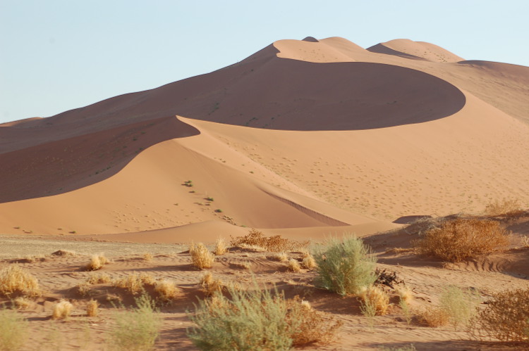
South from Swakopmund across the gravel plains of the Namib Desert lies the dramatic 23,000-sq-km Namib-Naukluft National Park. The park is the site of some of the most spectacular dunes on the planet, particularly in the area around Sossusvlei. Here, the winds have shaped the bright orangey-red sands into elegant parabolic shapes hundreds of metres high. There are numerous options to sleep at just outside the park near Sossusvlei, but if you want to climb the vivid orange dunes for sunrise you must stay within the park at Sesriem Camp Site or Sossus Dune Lodge, both of which are near Sesriem gate. The drive into the dramatic dunefield is possible in a 2WD vehicle, as long as you do stick to the tarmac and graded sections of road – famous Dune 45 is easily reached. Sossusvlei pan, the area's namesake, is 4km beyond the tarmac road's end, but there is a car park at its terminus, from which you can walk or grab the park shuttle. Sossusvlei pan, shaped over time by the Tsauchab river and surrounded by orange-hued dunes, is incredibly scenic. On very rare occasions it floods, setting up incredible mirrored photographs with the dunes and deep blue sky. Nearby is Deadvlei, the stuff of National Geographic pictures: a flat, cracked ephemeral pan, towered over by Big Daddy (at 330m, one of the tallest dunes in the world) and dotted with charred remains of the camel-thorn acacia trees, burnt black by the sun, are carbon dated between 500 and 600 years old.
From Sossusvlei's Sesriem gate, the 300km drive back to Windhoek takes four and a half hours.
This article was first published in May 2012 and was updated in October 2014 with additional research by Matt Phillips.