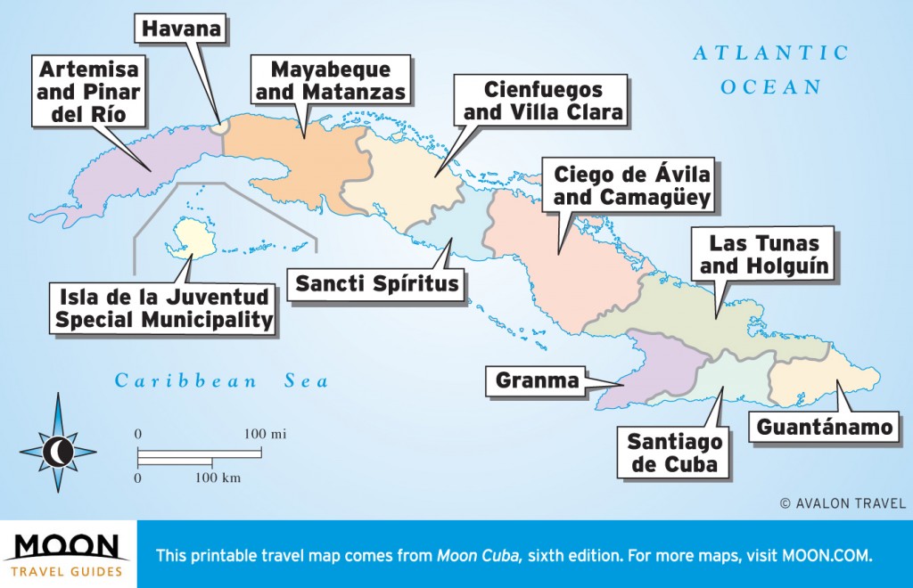
Cuba travel maps by region.
Cuba is a diverse country with a lot to offer travelers. Kick-start your trip planning with this helpful overview of travel-worthy sights and destinations.
Havana
Habana Vieja (Old Havana) is the colonial core, full of plazas, cathedrals, museums, and bars.
Parque Histórico Militar Morro-Cabaña preserves the largest castle in the Americas. The
Vedado district teems with beaux-arts, art nouveau, and art deco mansions; a magnificent
cemetery; and the one-of-a-kind
Plaza de la Revolución. There are even gorgeous
beaches nearby.

Havana
Artemisa and Pinar del Río
These valleys are where the world’s finest tobacco is grown.
Viñales has magnificent scenery, plus preeminent
climbing and
caving. Scuba divers rave about
Cayo Levisa and
María la Gorda. Península de Guanahacabibes has birding and hiking trails, as does
Las Terrazas, Cuba’s most developed eco-resort. Head to
Finca El Pinar San Luis for Tobacco 101.
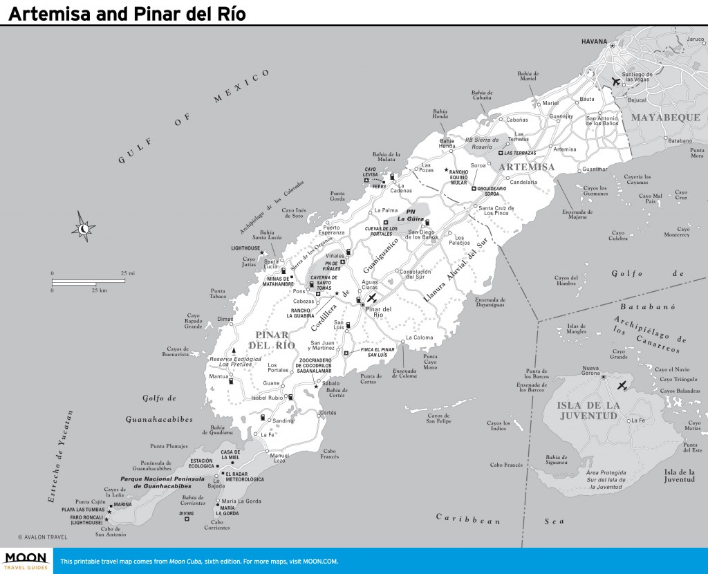
Artemisa and Pinar del Río
Isla de la Juventud Special Municipality
Slung beneath Cuba, this archipelago draws few visitors. The exception is
Cayo Largo, a coral jewel with stupendous beaches.
Isla de la Juventud boasts
Presidio Modelo (the prison where Fidel was held);
Refugio Ecológico Los Indios, great for birding; and Cuba’s finest
diving off
Punta Francés. Two days is all that’s required to explore Isla de la Juventud, plus two days more for Cayo Largo.
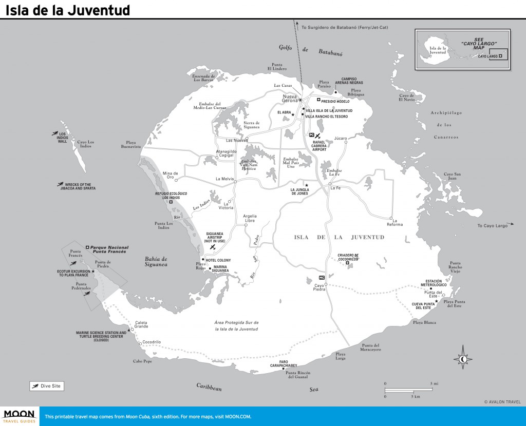
Isla de la Juventud
Mayabeque and Matanzas
Cuba’s premier beach resort,
Varadero, has the lion’s share of hotels, plus Cuba’s only 18-hole
golf course and exceptional
diving. Colonial-era
Matanzas is a center for
Afro-Cuban music and dance. The Caribbean’s largest swamp—the
Ciénaga de Zapata—offers fantastic
birding and
fishing. Nearby,
Playa Girón, site of the 1961 Bay of Pigs invasion, has an engaging
museum.
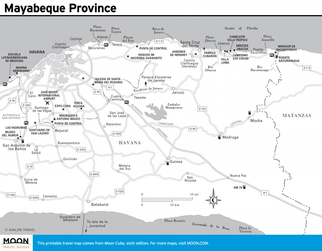
Mayabeque Province
Cienfuegos and Villa Clara
Bird-watchers and hikers are enamored of the
Sierra Escambray, where
forest trails lead to
waterfalls. Santa Clara draws visitors to the
mausoleum and museum of Che Guevara.
Sleepy Remedios explodes with fireworks during the year-end parranda and is gateway to the beaches of Cayos de Villa Clara. Cienfuegos offers French-inspired colonial architecture and a world-class botanical garden, the Jardín Botánico Soledad.
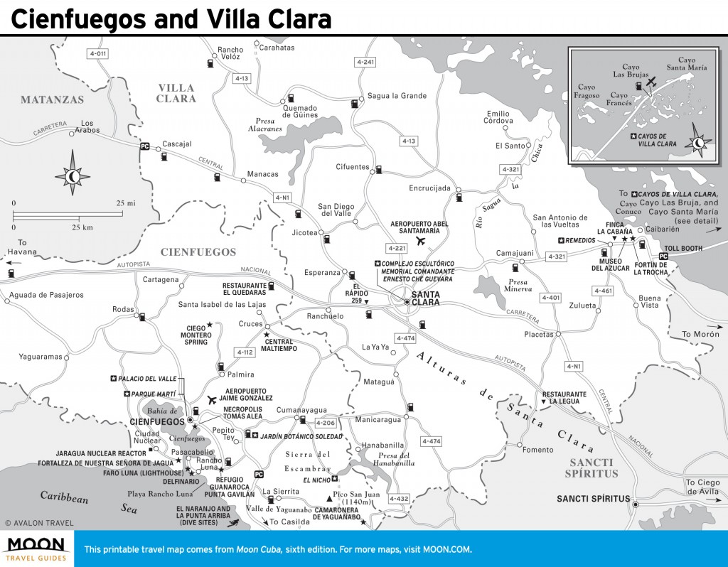
Cienfuegos and Villa Clara
Sancti Spíritus
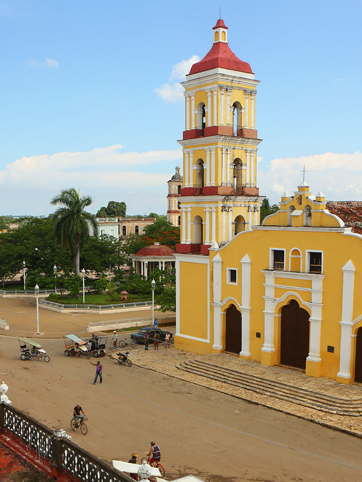
Sancti Spíritus is a charming hill town that is a crown jewel of
colonial architecture. It’s a great base for hiking at
Gran Parque Natural Topes de Collantes, lazing at
Playa Ancón, or riding a
steam train into the
Valle de los Ingenios.
The provincial capital, Sancti Spíritus, also has a colonial core worth exploring, and anglers are lured to Embalse Zaza to hook world-prize bass.
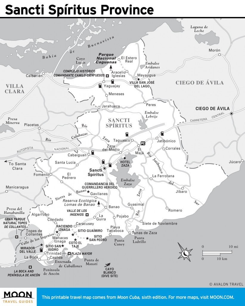
Sancti Spíritus Province
Ciego de Ávila and Camagüey
Tiny Ciego de Ávila Province is the setting for
Cayo Coco, the most developed isle of the
Jardines del Rey archipelago. Come here for magnificent
beaches and to view
flamingos. Playa Santa Lucía has some of Cuba’s best
diving.
The less developed Jardines de la Reina archipelago is a new frontier for anglers and divers. Camagüey city has quaint cobbled plazas and colonial architecture.
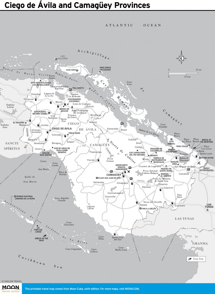
Ciego de Ávila and Camagüey Provinces
Las Tunas and Holguín
For travelers, Las Tunas Province is a place to pass through en route to history-packed
Holguín, with its intriguing
plazas and lively artistic
culture. Nearby are the beaches of
Guardalavaca, an archaeological site at
Museo Aborigen Chorro de Maíta, the alpine setting of
Pinares de Mayarí, and Fidel Castro’s birthplace at the
Museo Conjunto Histórico Birán.
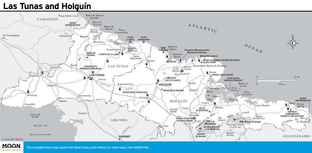
Las Tunas and Holguín
Granma
Off-the-beaten-path Granma Province is dominated by the
Sierra Maestra, the mountainous base for Fidel Castro’s guerrilla war. You can hike to his headquarters,
La Comandancia de la Plata, and to the summit of
Pico Turquino, Cuba’s highest peak. Independence was launched in
Bayamo, touting a vibrant
colonial plaza. For scenery, the lonesome coast road east of the ho-hum beach resort of
Marea del Portillo can’t be beat.
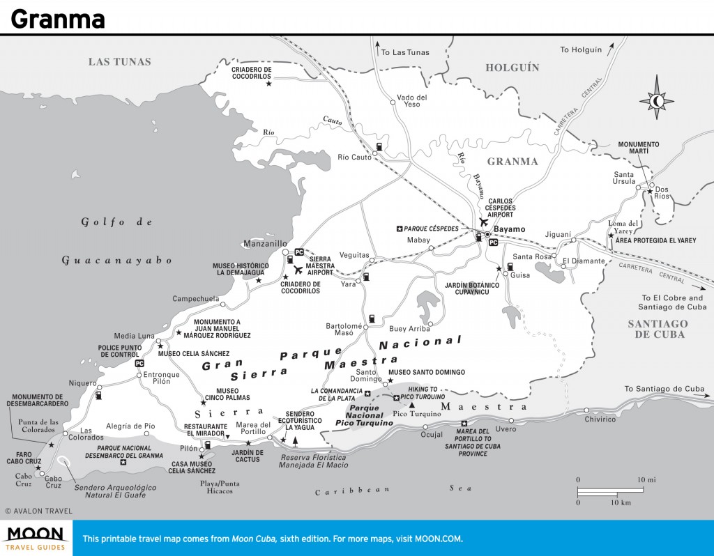
Granma
Santiago de Cuba
The city of
Santiago de Cuba, founded in 1514, predates Havana and has strong Haitian and Jamaican influences. Much of Cuba’s
musical heritage was birthed here. The
Moncada barracks, museums, and
mausoleums recall the city’s revolutionary fervor. At sunset, visitors flock to
Castillo de San Pedro del Morro for a
cannon-firing ceremony; in July it hosts Cuba’s preeminent
Carnaval. Explore the eclectic attractions of nearby
Reserva de la Biosfera Baconao and the basilica at
El Cobre.
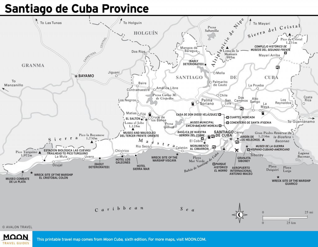
Santiago de Cuba Province
Guantánamo
This mountainous province is synonymous with the
U.S. naval base, which can be viewed from a hilltop restaurant at Glorieta. The town of
Guantánamo has a lovely colonial plaza and is alive with
traditional music. Nearby the
Zoológico de Piedra—literally a stone zoo!—fascinates. The
La Farola mountain road leads to
Baracoa, Cuba’s oldest city, full of vernacular charm and boasting Cuba’s most dramatic physical setting. Some of the nation’s best birding and hiking can be enjoyed at
El Yunque and
Parque Nacional Alejandro de Humboldt.
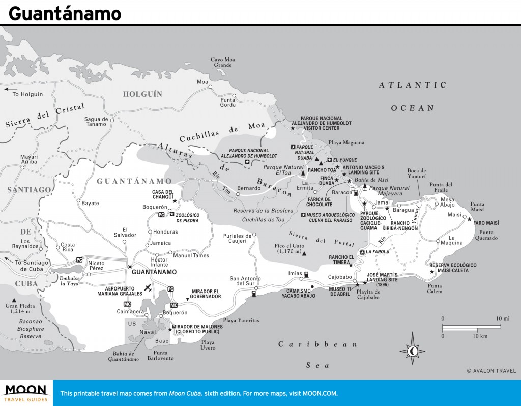
Guantánamo
Excerpted from the Sixth Edition of Moon Cuba.