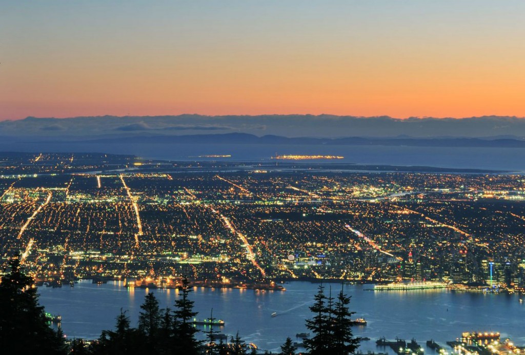
View of Vancouver from Grouse Mountain at dusk. Photo © Lijuan Guo/123rf.
Whenever I visit a city for the first time, I like starting off by finding a viewpoint that lets me see the layout of the city. In Vancouver the obvious option to get your bearings is by taking a flightseeing trip in a helicopter or floatplane, but this also means paying out big bucks. Instead, consider one of the following less expensive options.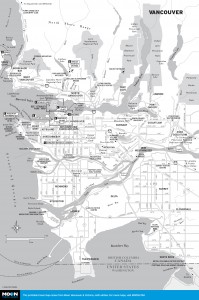
Vancouver
Vancouver Lookout: For immediate orientation from downtown, catch the high-speed, stomach-sinking glass elevator up the outside of 40-story Harbour Centre (555 W. Hastings St., 604/689-0421, 8:30am-10:30pm daily in summer, 9am-9pm daily the rest of the year, adult $16, senior $13, student $11, child $7.75). The ride takes less than a minute and ends at the Observation Deck, an enclosed room 130 meters (426 feet) above street level, where views extend as far away as Mount Baker, 140 kilometers (87 miles) to the south. Walk around the circular room for 360-degree views. Keep your receipt and you can return anytime during the same day (the top of the tower is a great place to watch the sun setting over the Strait of Georgia).
Down on the Waterfront: From Vancouver Visitor Centre, continue down Burrard Street to Canada Place and wander around the west side promenade for neck-straining views of the city close up, as well as North Vancouver and the rugged mountains beyond. For a look at the skyline and sparkling Canada Place from sea level, take the SeaBus from the adjacent Waterfront Station across Burrard Inlet to Lonsdale Quay.
Stanley Park: Drive, walk, or cycle Stanley Park’s 10-kilometer (6.2-mile) Seawall Promenade to appreciate the skyline to the east, the busy shipping lanes of First Narrows to the north, and the sandy beaches of English Bay to the west. Sunsets from English Bay Beach, in the West End, are delightful.
The best views from the north side of Burrard Inlet are gained by taking the Grouse Mountain Skyride (Nancy Greene Way, 604/980-9311, adult $40, senior $36, youth $24, child $14, includes on-mountain activities) up the slopes of Grouse Mountain. The panorama extends back across the inlet to downtown and beyond to Mount Baker, in Washington State, and west to Vancouver Island. In summer, the gondola departs from the base station every 10 minutes 9am-10pm.
Head west along Highway 1 from the Grouse Mountain turnoff to Cypress Bowl Road. At the second switchback there’s a particularly good city skyline view. Continue west to Horseshoe Bay; then return to the city along Marine Drive, which parallels Burrard Inlet, providing many glimpses of the city skyline. At Lighthouse Park, along this route, English Bay, Stanley Park, and Kitsilano Beach are laid out in all their glory from Point Atkinson.
South of downtown, the Kitsilano foreshore provides that well-known view of the city skyline backed by the Coast Mountains. The south side of the city is relatively flat. The high point is 152-meter (500-foot) Little Mountain, in Queen Elizabeth Park, where the city skyline and abruptly rising mountains contrast starkly with the residential sprawl of Vancouver.
Excerpted from the Sixth Edition of Moon Vancouver & Victoria.