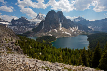
Mt Assiniboine
TIME : 2016/2/22 10:07:42
Mt Assiniboine
Known as the “Matterhorn of the Rockies” at nearly 12,000 feet up, Mt Assiniboine is one of the region’s highest peaks. When the mountain was first spotted on the Great Continental Divide between British Columbia and Alberta’s Banff National Park by Canadian scientist George M. Dawson in 1885, he named the peak Assiniboine because its dramatically pointed top reminded him of the teepees of the Assiniboine people.
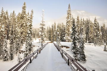
Nestled near the crystal clear waters of Lake Magog, Mt Assiniboine provides a true backcountry experience; British Columbia’s Mt Assiniboine Provincial Park has no roads whatsoever. A trip to the park requires at least a six-hour, 17-mile hike via Bryant Creek near Canmore. Alternatively, you can take a helicopter to visit this UNESCO World Heritage wilderness of alpine meadows, glaciers and waterfalls.
Practical Info
There are no scrambling routes up Mt Assiniboine. The safest mountaineering routes are the North Ridge and North Face, though the climb should only be undertaken by serious rock climbers and mountaineers. Popular hiking routes into Mt Assiniboine Provincial Park include the 17-mile valley route via Bryant Creek and the dramatic Valley of the Rocks route from Sunshine Meadows (22 miles) in Banff National Park. Camping and lodging is available within the park.