Mt Tauhara
TIME : 2016/2/22 12:11:24

Mt Tauhara
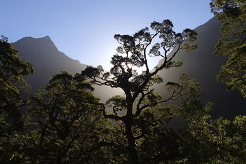
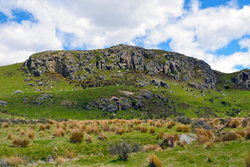
Lake Taupo is best known for all of its different watersports, but it’s also one of the best places for hiking on the North Island of New Zealand. For one of the best views in all of Lake Taupo, the steep trek up Mt. Tauhara offers panoramic views of the Taupo lakeshore and the surrounding mountains of the North Island. At an elevation of 3,500 feet, this dormant volcano is a shorter alternative to the Tongariro Crossing, and while the trail isn’t as groomed as some of the longer, more popular hikes, the view, the silence, and the absence of crowds create the perfect day trip from Lake Taupo.
The climb to the summit is short—but steep—and hikers should be in fairly good shape for the 90-minute climb to the top. What begins as a trail through a grove of beech forest quickly turns to pastureland, and eventually terminates in a sweeping view of the central plains of the North Island. To the south, the snowcapped peak of Mt. Ruapehu rises from Tongariro National Park, and the cobalt dollop of Lake Taupo shimmers amidst the North Island plains. Looking north, the view on a clear day can stretch all the way out towards the beaches of the Bay of Plenty, where the volcanic peak of White Island rests on the northern horizon. The walk back down is short but steep, and if your legs feel like mush at the bottom of the trail, you can soothe your muscles with a relaxing soak in one of Taupo’s natural thermal pools.
Practical Info
Mt. Tauhara is located 20 minutes from the downtown section of Taupo. To find the trailhead, travel east towards Napier on Highway 5 before making a left on Mountain Road. Follow Mountain Road all the way to the end and there will be a small, paved parking lot. From the parking lot, continue on a short, unpaved road before the trail climbs over a fence and into the grassy cow pasture. Follow signs from here.