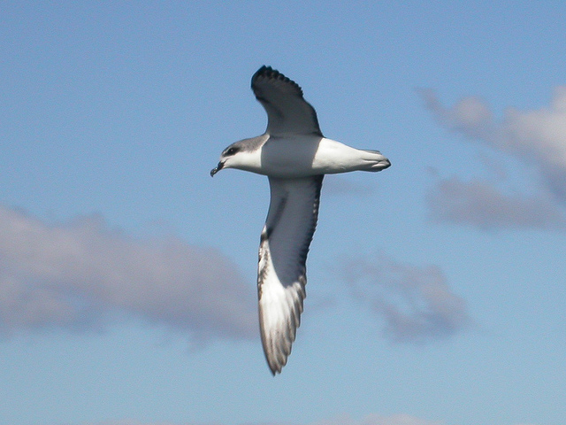
Cook’s petrel (Pterodroma cookii defilippiana) can be spotted in the area, but have suffered heavily from predation. Photo © Ron Knight, licensed Creative Commons Attribution.
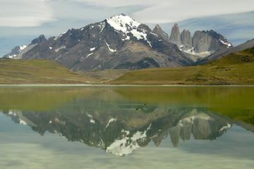
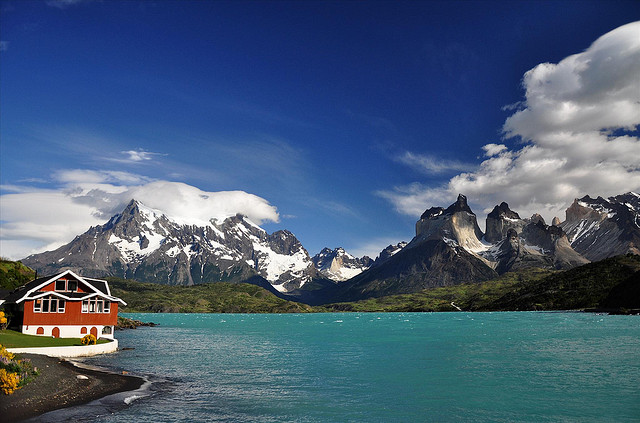
Almost contiguous with the archipelago, excluding only San Juan Bautista and the airfield at Robinson Crusoe’s southeast corner, Parque Nacional Archipiélago Juan Fernández comprises 9,571 hectares of protected land that varies from barren desert to dense endemic forest on Isla Robinson Crusoe, Isla Santa Clara, and Isla Marinero Alejandro Selkirk. From a wildlife perspective, it’s noteworthy for what it excludes: All the surrounding offshore areas fall under jurisdiction of the navy’s Gobernación Marítima.The boat trip from Bahía del Padre to San Juan Bautista is a good introduction to Robinson Crusoe’s geography as it covers nearly half the island’s circumference. But hiring a launch in San Juan offers greater flexibility and the option, if seas permit, of going ashore in otherwise inaccessible areas. Figure about US$250 for a five-hour circumnavigation of the island; expenses can be shared by up to 8 or even 10 people. At San Juan, Conaf collects park admission (US$6 pp adults, US$1.60 children).
Many attractions are within walking distance of San Juan Bautista, but often only via a rugged hike. Its signature excursion is the Mirador de Selkirk, on a scenic trail that continues to Bahía Tierras Blancas (site of a large fur seal colony) and the airstrip where flights from the mainland arrive.
At the south end of San Juan, swimmers dive off the rocks at El Palillo, where Conaf has a wooded 15-site picnic ground (no camping) with fire pits and trash collection; this is also the officially designated site of the Sendero de Chile’s only submarine sector (accessible to divers). From El Palillo, a trail switchbacks up the hillside before leveling out and joining the road to Hostería Pangal.
At the foot of the island’s highest peak, Plazoleta El Yunque is a shorter, easier hike than Selkirk’s lookout. Beginning at the power plant and gaining only 257 meters in three kilometers, the road becomes a footpath that leads to this placid forest clearing where Hugo Weber, who escaped the Dresden’s sinking, built a house whose foundations still survive. Conaf maintains a picnic area here, and permits one night’s camping.
From Plazoleta El Yunque, Conaf permission and a guide are necessary to ascend the steep rugged route to El Camote, a saddle with views to match those of Selkirk’s lookout, particularly the sight of El Verdugo, a sheer volcanic needle that rises 157 meters out of the sea. The climb to El Camote, through thick native forest, requires at least as much arm strength as hiking ability, as it often requires pulling yourself up by tree limbs. Cerro El Yunque itself, a 915-meter pinnacle, is not unattainable, but it’s not for dilettantes either; a Conaf-approved local guide is imperative.
Only a short shot north of San Juan Bautista by launch, Puerto Inglés is the site of Selkirk’s replica shelter; camping is possible here. For non-hikers, the launch to Puerto Inglés costs about US$50 for a minimum five people; in rough seas, the landing is tricky and the rocks are slippery.
Puerto Inglés is about two hours away starting at the zigzag Sendero Salsipuedes, which climbs from the west end of Calle La Pólvora; passing through nonnative forest of acacia, eucalyptus, Monterey cypress, and Monterey pine, the newly rerouted trail to the Salsipuedes ridge provides some of the best village and harbor views. Beyond the ridge, though, the descent to Puerto Inglés requires a local guide.
On a small inlet on Crusoe’s north shore, Puerto Vaquería features a small fur seal colony and a Conaf refugio. The landing is equally if not more awkward than that at Puerto Inglés. Camping is possible, and a local guide is obligatory.
On Crusoe’s eastern shore, about half an hour by launch from San Juan Bautista, Puerto Francés is a desert area where the presence of French pirates led Spain to build a now-ruined set of ramparts overlooking the sea. From the Conaf refugio (shelter) here, a trail climbs the Quebrada Los Picos through thickening forest to Cerro La Piña; a longer trail connects Quebrada Los Picos with Pangal (local guide obligatory).
Rarely visited except by lobstermen (they are all male), Conaf’s seasonal ranger, and the odd cruise ship, Isla Marinero Alejandro Selkirk (ex-Isla Masafuera) must be one of the earth’s loneliest places, even more so, in Selkirk’s time, than Masatierra (Selkirk had no connection whatsoever with the island that now bears his name). Catching a lift there with local fishermen is the only option but, even then, it depends on the weather and landings are difficult as there is no pier.
The park’s single most popular destination, the Mirador de Selkirk (Selkirk’s Lookout) is a stiff hike starting at Subida El Castillo, at the south end of San Juan’s plaza. Over a distance of 2,700 meters, it gains 565 meters in altitude for an average grade of nearly 21 percent. The initial segment passes through a badly eroded area that quickly becomes covered with blackberry vines and nonnative scrub before entering a dense native forest with a verdant undergrowth of ferns, some the size of trees. This is a designated nature trail, and Conaf’s inexpensive booklet Sendero Interpretativo Mirador Alejandro Selkirk describes the native and nonnative plants and wildlife and explains what environmental damage the area has suffered.
From a saddle on the ridge between the two sides of the island, the hiker’s reward is a series of views from Bahía Cumberland and San Juan on the north to the airfield to Isla Santa Clara on the south. On the saddle itself, two plaques honor Selkirk’s memory. Royal Navy officers placed the first, cast by John Child & Son of Valparaíso, which says:
In memory of Alexander Selkirk, Mariner, a native of Largo, in the county of Fife, Scotland, who lived on this island in complete solitude for four years and four months. He was landed from the Cinque Ports galley, 96 tons, 16 guns, a.d. 1704 and was taken off in the Duke, privateer, 12th Feb., 1709. He died lieutenant of HMS Weymouth, a.d. 1723, aged 47 years. This tablet is erected near Selkirk’s lookout, by Commodore Powell and the officers of HMS Topaze, a.d. 1868.
The second, placed nearby by a Scottish relative, reads:
Tablet placed here by Allan Jardine of Largo, Fife, Scotland, direct descendant of Alexander Selkirk’s brother David. Remembrance ‘Till a’ the seas gang dry and the rocks melt in the sun.’ January 1983.
From the saddle, where wind and fog can make the weather far cooler than at sea level, the trail descends through densely vegetated Sector Villagra before emerging onto the desert side of the island; it’s about 10 kilometers farther to the airfield on a path that, for most of its length, is wide enough for a Hummer. Villagra has a ranger station and campground where islanders gather for the summer rodeo, in early February.
Through hikers should carry water, as the only reliable sources en route are a conspicuous pipe where the trail crosses Estero El Castillo (San Juan’s water supply) and begins to switchback toward Selkirk’s lookout, and a spring that drops over a rock outcrop just west of the Villagra turnoff.
Just before reaching the airfield, the trail from San Juan passes an unmarked but conspicuous lateral that descends to the island’s principal fur seal colony at Bahía Tierras Blancas. The zigzag trail is wide, but it has loose volcanic rock and eroded gullies that require cautious scrambling to reach the seashore. Figure about two hours down and back, including time to photograph the seals (keep a respectful distance from the animals).
Some visitors hike to the airfield to catch their flights back to the mainland, but this requires an early departure and might limit your time at the seal colony. On the other hand, if the flight is delayed for weather conditions, it might entail camping a night at the barren airfield. Another option is to hike from the airfield to San Juan; it’s possible to do this on arrival, as the boat to San Juan will normally deliver your baggage to your accommodations.
It’s also possible to spend the first night or more in San Juan, then catch a boat to Bahía del Padre for a hike back to the village on another day; this ensures an earlier arrival at San Juan, with more time for sightseeing breaks. The western approach is also more gradual, though it also climbs steeply to Selkirk’s lookout. Still, it takes 4–5 hours, even longer with wet weather.
Having evolved in oceanic isolation, about 70 percent of the archipelago’s plant species are endemic, despite broad similarities with flora from tropical Hawaii, the Andean highlands, temperate New Zealand, and sub-Antarctic Magallanes. Even at the genus level, nearly 20 percent of the flora is endemic.
There exist three principal plant communities: the evergreen rainforest, an evergreen heath, and an herbaceous steppe. In all likelihood, the lushly diverse evergreen forest once reached to the shoreline, but aggressive introduced plant species, imported both intentionally and accidentally, and damage from non-native grazers such as goats and cattle have squeezed it out of the lower elevations. On higher slopes, climbing vines cover the trunks of endemic trees such as the luma (Nothomyrcia fernandeziana) and the chonta palm (Juania australis), which shade a verdant understory of tree ferns such as Dicksonia berteroana and Thyrsopteris elegans. In Selkirk’s time, visiting mariners gathered forest products such as the fruits of the wild cabbage tree Dendroseris litoralis, which Woodes Rogers praised as “very good.”
On shallow soils at higher elevations, or on nearly sheer gradients, the evergreen heath features smaller trees of the genus Robinsonia and tree ferns such as Blechnum cyadifolium. In the drier southeastern part of Isla Robinson Crusoe and on Isla Santa Clara, bunch grasses such as Stipa fernandeziana provide patchy cover on the steppe.
The replacement of native flora was well under way even during colonial times, when privateers planted their own gardens. When Maria Graham visited the island with Lord Cochrane in 1823, they found apples, cherries, pears, and quinces, and mint and parsley. Barely a decade later, wrote Richard Henry Dana,
Ground apples, melons, grapes, strawberries of an enormous size, and cherries, abound here. The latter are said to have been planted by Lord Anson.
Other species have been less benevolent and even invasive, such as the wild blackberry (Rubus ulmifolius) and the maqui (Aristotelia chilensis), a shrub that has displaced native forest but has an important economic use for lobster traps.
The Juan Fernández group has no native land mammals, but 60 percent of its land bird species are endemic, most notably the strikingly red male Juan Fernández hummingbird (Sephanoides fernandensis), which feeds on the native cabbage trees. Ground-nesting seabirds, most notably Cook’s petrel (Pterodroma cookii defilippiana), have suffered depredations from exotic mammals such as the Norway rat, the domestic cat, and the South American coatimundi.
Morrell and his contemporaries pursued the Juan Fernández fur seal to near extinction, but Conaf now counts some 80,000 individuals (admittedly a small fraction of the hundreds of thousands killed by 19th-century sealers) on the archipelago’s three islands. The near absence of a continental shelf provides little habitat for inshore fauna, but the misleadingly named Juan Fernández lobster (Jasus frontalis is really a crayfish) fetches premium prices in Santiago restaurants.
Excerpted from the Fourth Edition of Moon Chile.