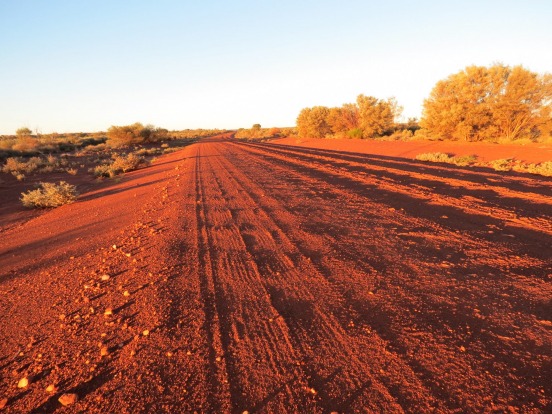
The Outback Way is the granddaddy of shortcuts, Australia's longest. Stretching an epic 4615 kilometres from Perth to Cairns via Uluru and Alice Springs on a network of well-maintained dirt roads such as the Great Central Road and the Plenty Highway, it's not exactly short but it certainly cuts – about 1000 kilometres compared with driving Highway 1 and other main roads. See outbackway.org.au.
When it comes to quick escapes, those bushrangers knew a thing or two, so follow the trail of Captain Thunderbolt next time you head north-west from Sydney to Armidale and the New England region. Thunderbolts Way, via Gloucester and Walcha, is not only prettier and virtually traffic-free compared with the New England Highway It's 50 kilometres shorter as well. See thunderboltsway.com.au.
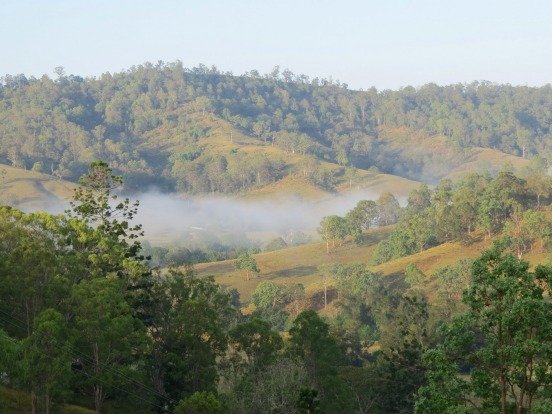
The best shortcuts are more than just a quick way to get from A to B; they are also often the most scenic way to get there as well. The Barrington Tops Forest Road is a 144-kilometre-long ribbon of road (mostly loose gravel) between Gloucester and Scone in the upper Hunter Valley. Compared with the highway options that go around the mountains to the south (via Singleton) or north (via Nowendoc) it can be slow going at times – it's narrow and windy, and can be closed by snow at the top – but by going over "the Tops" you'll save up to 150 kilometres and be treated to some of the magnificent mountain views at the same time.
Another fabulously scenic shortcut is the Lions Road, a privately maintained community-built road through the Richmond Gap in the McPherson Range between Kyogle in northern NSW and Rathdowney in Queensland. It's 30 kilometres shorter than the Summerland Way/Mount Lindesay Highway route and punches way above its weight when it comes to knockout views.
Heading even further north to the tropics? Take the back way through western NSW and Queensland. The Great Inland Way from Sydney to Townsville via Dubbo, Lightning Ridge, Roma, Emerald, Carnarvon Gorge and Charters Towers is about 200 kilometres shorter than the well-travelled coastal route (aka the Pacific and Bruce highways) and is fully sealed, but be warned, the small towns along the way are so full of fascinating things to see and do that it will probably take you twice as long as you think.
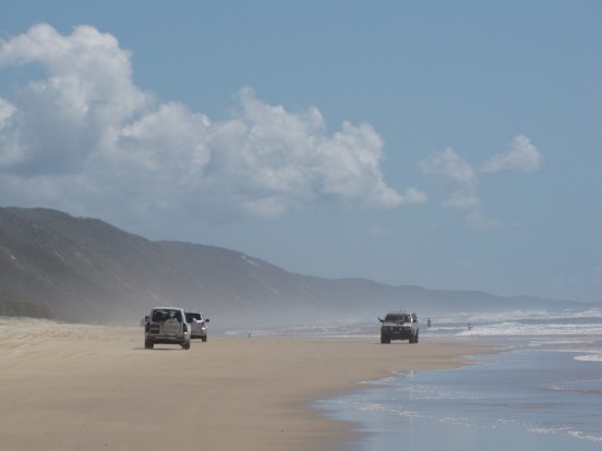
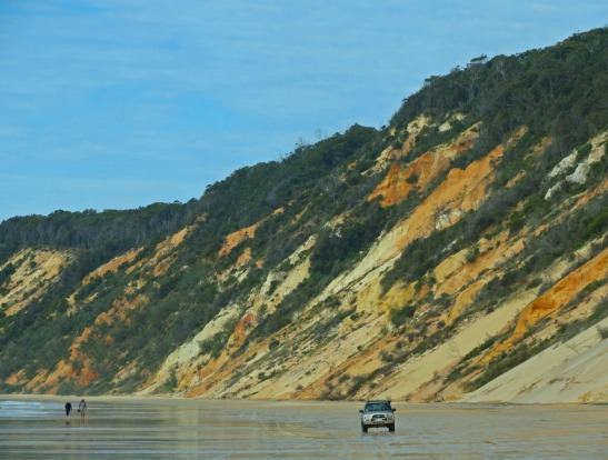
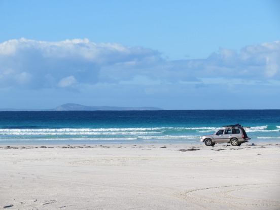
You'll need a four-wheel-drive vehicle to travel the Beach Highway between Noosa and Rainbow Beach on the Queensland Sunshine Coast, and you'll need to time your drive to coincide with low tide, but as far as shortcuts go, this is one of the very best. It's a 70-kilometre run along the beach (that's on the beach, not beside it), so, of course, it's scenic, and it's about an hour quicker than the Bruce Highway. What's not to love about that? See australiasnaturecoast.com.
You'll also need a 4WD for this (in)famous shortcut through the Daintree Rainforest between Cape Tribulation and Cooktown, and although the building of a new bridge across the Bloomfield River in 2013 has made it an easier run than it used to be, it can still be a challenging and sometimes slippery drive. It's about 20 kilometres shorter than the all-sealed Mulligan Highway alternative, and will probably take twice as long, but you're guaranteed to have a whole more fun.
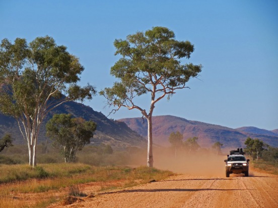
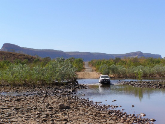
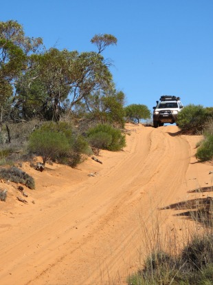
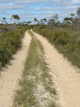
The quickest way to get from the Red Centre to the Kimberley, the Tanami spears through the desert from Alice Springs to Halls Creek, where you can hook up with the Great Northern Highway to get to Broome. It's mostly gravel and is very remote, so carry extra water and a jerry can of spare fuel. It's 1046 kilometres from Alice to Halls Creek – 1000 kilometres less than if you take the black-top alternative via Katherine and Kununurra.
Shorter doesn't always mean quicker. The Gibb River Road is almost 130 kilometres shorter than Great Northern Highway alternative, but will take you twice as long. Yes, there's plenty to see and do along Highway 1, and yes the Gibb's a bit rough and dusty in places, but it's the Gibb that will lead you to all the Kimberley's best bits.
If you don't mind a bit of rugged deep sandy adventure, the rough 4WD track from Balladonia Roadhouse on the western end of the Nullarbor down to the southern coast is almost 150 kilometres shorter than sticking to the main road through Norseman to Esperance. It's also a great way to get to the white sand beaches of Cape Arid National Park, one of the unsung wonders of the deep south.
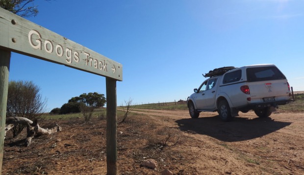
A fantastic shortcut from the western top of the Eyre Peninsula to the Trans-Australia Railway Line near Tarcoola, which then links up to the Stuart Highway 200 kilometres south of Coober Pedy, Googs Track is a 150-kilometre-long desert adventure drive across more than 360 sand dunes. One for experienced four-wheel-drivers only.
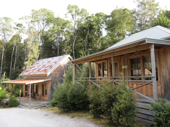
Most tourist maps don't even show the Western Explorer Highway that runs north from Strahan to Stanley on Tasmania's wild west coast, but it's a fantastic alternative to the 100-kilometre-longer A10 route that almost everyone mistakenly thinks is the only way to drive between the two tourist towns. It's unsealed, but you don't need a 4WD, and it spears though the heart of the Tarkine, the world's largest remaining stretch of temperate rainforest. More than just a shortcut, it's one of the Australia's best wilderness drives.