In the American psyche, it’s a powerful life force, a natural wonder that has created bounty and a marvelous place to play.
Yet it’s a fragile existence. The Colorado River no longer reaches the sea but runs dry in the Mexican desert. Prolonged droughts in California and the Southwest mark a larger pattern of diminishing river flows and water supply in the West. Conservation has become a necessity.
Nearly fifty years after Edward Abbey penned Desert Solitaire, a rebellious account of the author’s experiences in the American wilderness, travel here still maintains the aura of pilgrimage. Abbey, who cursed what he called ‘industrial travel’ in favor of landscape immersion that was more sustainable, protective and slower, was surely onto something. Slow travel can help preserve these fragile environments with wilderness journeys made on foot, on two wheels or by raft.
Rocky Mountain Headwaters
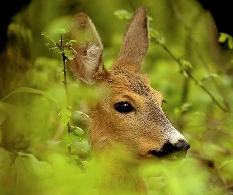
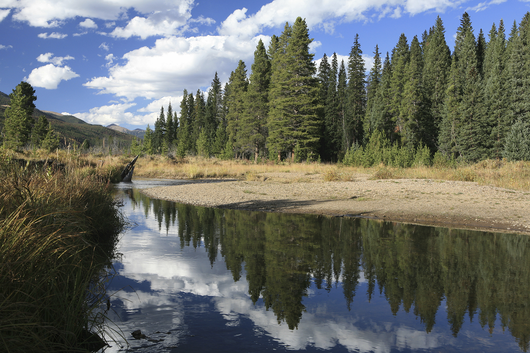
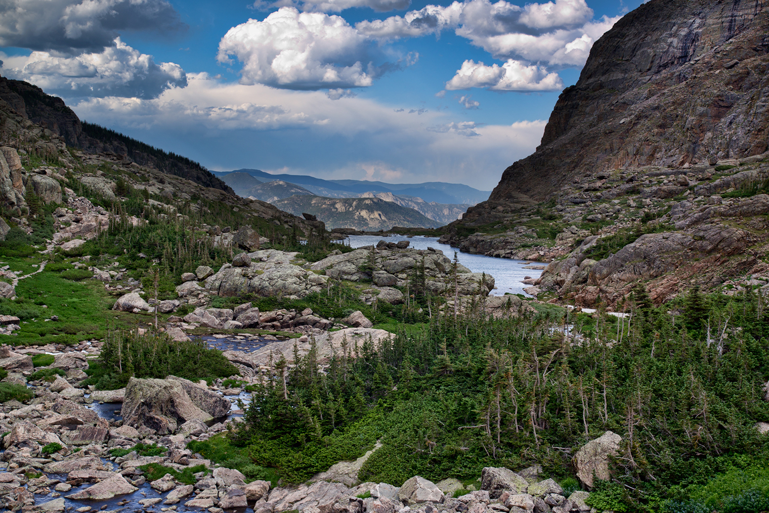
The Colorado River is born as a trickle in Rocky Mountain National Park, a hiker’s paradise of lush valleys of alpine lakes and clear streams that glisten under the snowbound peaks of northern Colorado. The park offers hiking in summer, snowshoeing in winter, and the chance to glimpse a bighorn sheep, marmot or elk on its home turf.
Start your hike with the free shuttle to the Bear Lake Trailhead. From here, families can take the stroll to Alberta Falls. Backpackers should pick up an overnight permit from the backcountry office to explore the stunning Glacier Gorge, best enjoyed when summer wildflower season paints a riot of color in the alpine basins.
Peak baggers train their gaze on 14,0255ft Longs Peak. A beacon to Front Range cities, it’s among Colorado’s most challenging 14ers. Those without extensive mountain experience can improve their odds for a successful summit bid with the help of Colorado Mountain School, which offers guides and classes for mountaineering in the park. The gateway town of Estes Park offers services geared toward park visitors including bars, restaurants and accommodations. The best deals are the rustic cabins in a woodsy setting run by YMCA of the Rockies (ymcarockies.org).
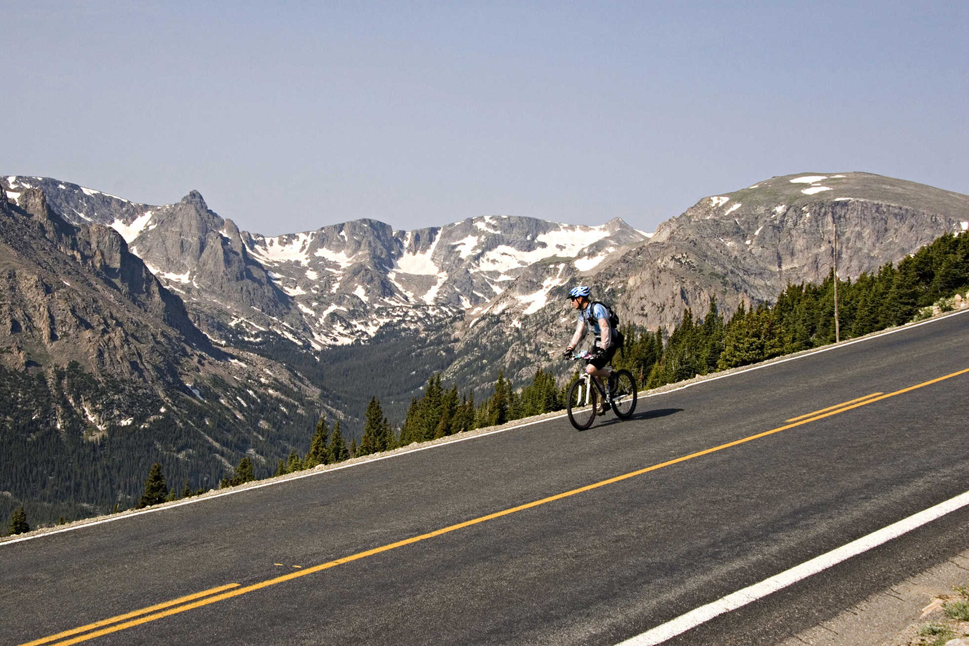
Dubbed the highway to the sky, Trail Ridge Road (US 34) traverses the park, up and over the Continental Divide, climbing four thousand feet in a series of dizzying hairpin turns. Then the road reaches wide-open tundra with a panorama of peaks. Before going, check the park website for seasonal road closure dates. The area has struggled with pollution in recent years, so consider low-emissions transportation. For a more sustainable road trip, hybrid cars are available at most Denver car rental agencies, and bicycling is available throughout the park.
Desert Adventure
After a jog across Colorado’s Western Slope, the river traverses southwest Utah, touching Arches National Park and outdoor capital Moab before reaching Canyonlands, another must-see national park. These fragile environs make up the battleground for debates on land use (motorized vs non), as well as development and resource exploitation, with a current appeal on pipelines planned on the public lands near Dead Horse Point State Park and Canyonlands.
Moab is a hub of desert adventure. Between mountain biking, canyon hikes and desert floats, you could spend a lifetime exploring this maze of desert landscapes and never get bored. In this star-studded, bone-dry setting, the best accommodations are campgrounds, best reserved in advance during the spring and fall high seasons.
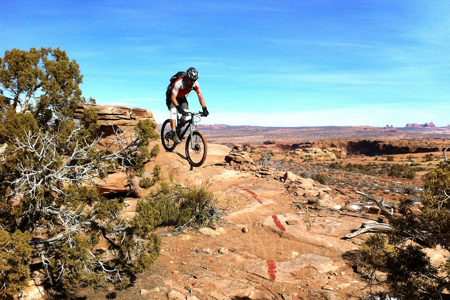
Mountain bikers first put Moab on the map, drawn by Slickrock Trail’s rollercoaster terrain, accessible from the town center. A mellower alternative goes through Dead Horse Point State Park. Post ride, the Lycra crowd lines up at Milt’s Stop & Eat (miltsstopandeat.com) for thick butterscotch shakes served with greasy-good burgers made with buffalo or grass-fed beef, local produce and fresh-cut fries.
Those with more fat tire ambition can take on the stunning 4-day, 70-mile White Rim Trail through Canyonlands National Park. Western Spirit Cycling Adventures (westernspirit.com) offers van-supported trips – a big improvement on lugging all your own water.
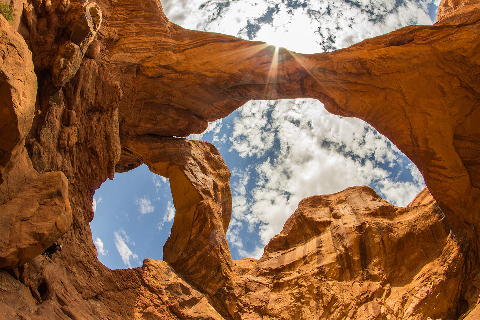
Just outside Moab, the strange and stunning landscape of Arches National Park offers easy hikes to its numerous red rock namesakes, interspersed with rock windows, fins and spires. But this small park is just a taster. For much more of a good thing, head out to the Needles District of Canyonlands, 75 miles south of Moab. The 11-mile Chesler Park-Joint Trail takes hikers on an all-day odyssey through a narrow slot canyon, clambering over slickrock towers and across open grasslands.
Rafting the Grand Canyon
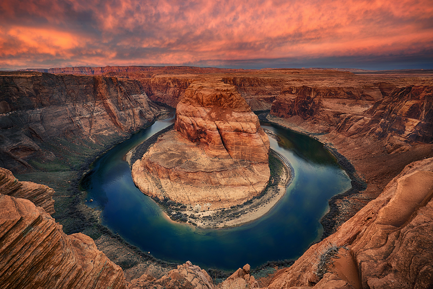
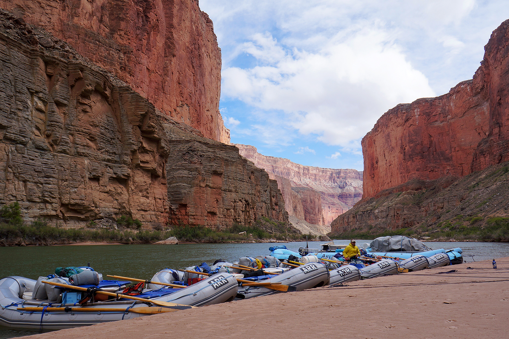
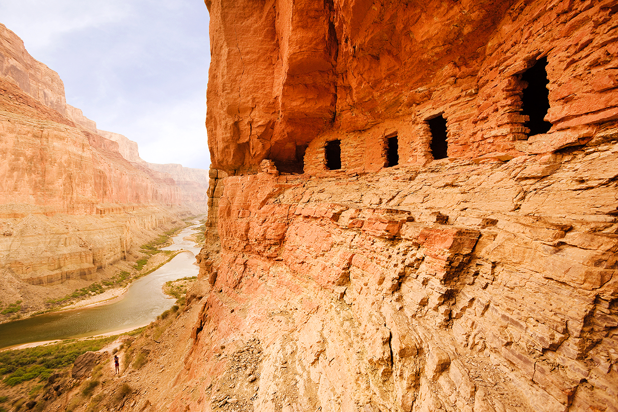
Over 4.5 million people visit the Grand Canyon every year, but because the National Park Service restricts the number of people allowed on the water, rafters can experience the Colorado River's winding course in relative solitude. And what an experience it is. The 280-mile stretch from Lee’s Ferry to Lake Mead features 98 rated rapids, sandy beaches and ancient ruins that trace our human presence back 12,000 years.
Humans are but fleeting visitors here – at least that’s the idea. Current development proposals for a tramway on Navajo land and thousands of residences in Tusayan could drastically change the landscape and threaten aquifers that feed desert springs. Advocates for the park warn of the irreversibility of damaging one of America’s most iconic landscapes.
But for now, the canyon is a place of refuge. Under its walls, there’s no cell phone signal. Visitors can take cold-water baths and dry in the sun. As the rafts progress, the river carves deeper into the canyon, its burnished walls grow steeper and the increasing flow is more assertive. On foot, rafters can explore narrow side canyons of sculpted rock and cascading waterfalls, places with names like Elves Chasm and Havasu, which trick you into feeling like the first person on earth. The Anasazi cliff dwellings, petroglyphs and granaries will remind you otherwise.
Commercial trips usually run short sections, taking 3-13 days, mostly with motorized rafts. But there are alternatives for those who prefer to travel at the pace of the river. OARS (oars.com) uses wooden dories like those used in John Wesley Powell’s inaugural descent in addition to traditional oar-powered rafts. They can also carbon-offset your trip.
Best for experienced boaters, the coveted permits for do-it-yourself trips are meted out via a competitive national park lottery (nps.gov/grca) held each February. The system is actually kindest to newcomers, who have the best chance at a launch date.